
What is recorded here
Archaeological investigations in 1997 immediately below the foundation layer for the earliest cobbled floor of one of the outbuildings at Ballymount manor uncovered a limekiln. In profile the kiln is 1.2m wide and 0.71m deep, consisting of a flat base (1m wide) of limestone slabs (top 62.32m OD) with vertical walls of irregularly shaped stones 0.6m high (south) and 0.5m high (north). The kiln is filled by three deposits: a basal layer of white lime mortar, at most 0.13m thick, an intermediate level of mixed brown soil with orange clay flecks, at most 0.36m deep, and an upper boulder infill, at most 0.22m deep. Three sherds of Dublin-type ware and one of Leinster cooking ware were recovered from the fills indicating a medieval date (Conway, 1998, 22-23).
Compiled by Geraldine Stout
The monument record does not grant public access. Check the route and ask the landowner before entering private land.
- What survives
- Recorded monument
Places near here
 Castle (site of)House, fortified house · 27 yd
 Ballymount castleRuins · 32 yd
 RoadRoad, road/trackway · 46 yd
 Norman TowerRuins · 105 yd
 Ceremonial enclosure in Ballymount GreatCeremonial enclosure · 122 yd
 Holy well in KilnamanaghHoly well · 1447 yd
 Belgard RoadMemorial · 1541 yd
 Fitwalk CircuitWalking route · 1.2 mi
 Mayor's Mile (Finsish)Visitor information · 1.3 mi
 Tymon Park Yellow SlíWalking route · 1.3 mi
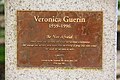 Veronica Guerin memorialMemorial · 1.4 mi
 Clondalkin Round TowerHeritage attraction · 1.4 mi
Other information
Photo: Credit not shown in the picture search · Rights wording not checked; contact us if this picture should be removed