What is recorded here
A kiln in the lower N area belongs to Phase 1. It is a truncated feature (dims 2.7m x 1m; D 0.3m) with a scorched base that was cut by gullies of Phase 1. A cereal grain from it was dated to 430-540 cal. AD. A second figure-of-eight kiln (dims 1.28m x 1.04m; D 0.68m) with a scorched base that was c. 20m S of the inner…
Read the whole record
From the National Monuments Service (Archaeological Survey of Ireland) record ME045-036004
Places near here
Photo credits
- Maker not stated on source page, ms.fusedlearning.com
- PST Sport (individual photographer not stated), pstsport.com
- Maker not stated on source page, commons.wikimedia.org
- Maker not stated on source page, www.mysteriousbritain.co.uk
- Maker not stated on source page, www.dreamstime.com
- Harold Strong, Wikimedia Commons · CC BY-SA 2.0
- National Inventory of Architectural Heritage
- Maker not stated on source page, fi.pinterest.com
- Maker not stated on source page, ru.pinterest.com
 Fairy fort / earthen ringfort in KilleglandFairy fort / earthen ringfort · 662 yd
Explorer Tom Fairy fort / earthen ringfort in Killegland wants to tell the N2 bypass: 'You could have just knocked first.' It’s a…
 Donaghmore/Ashbourne GAA pitchGAA ground · 1025 yd
 Killegland CemeteryGraveyard · 1149 yd
Explorer Tom Killegland Cemetery claims it can hear everything through the walls of the nearby cottages, including the arguments…
 Church in KilleglandChurch · 1155 yd
Explorer Tom Church in Killegland has strict rules for visitors: keep your knees off the mound and don’t ask about St Mogheanóg’s…
 Killegland CastleCastle, tower house · 1451 yd
Explorer Tom Killegland Castle is stuck in a feud with the river over who owns the view, and honestly, the river has more character…
 Catholic Church of the Immaculate ConceptionChurch/chapel · 1.0 mi
Explorer Tom Catholic Church of the Immaculate Conception gave up its stained glass windows for Lent, then put them back because…
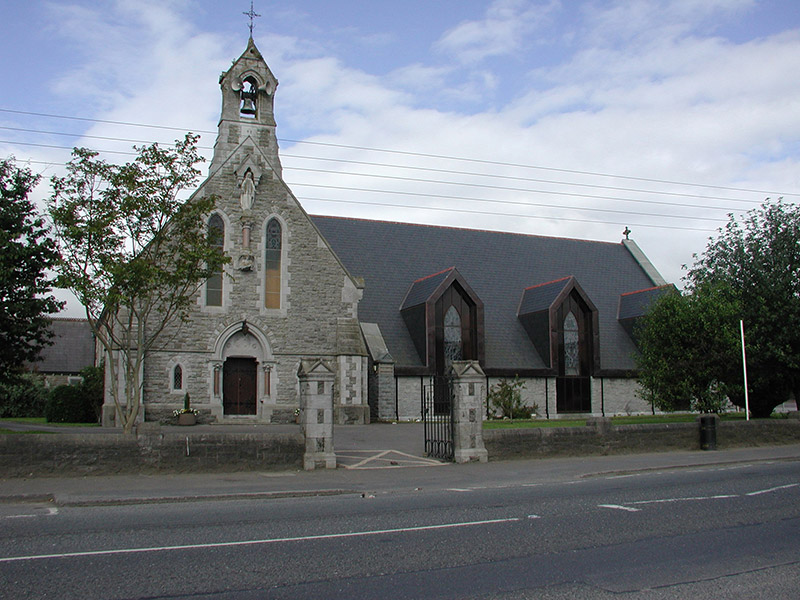 Ashbourne Parish HallSchool · 1.0 mi
Explorer Tom Ashbourne Parish Hall used to be a chapel, so it still expects you to behave, even though it’s just a school now. They…
 St. Declan's CemeteryCemetery · 1.8 mi
Explorer Tom St. Declan's Cemetery in County Meath smells like old wet wool and forgotten secrets, according to my very sensitive…
 Fairy fort / earthen ringfort in WottonFairy fort / earthen ringfort · 2.7 mi
Explorer Tom Fairy fort in Wotton has walls thin enough to hear the neighbours arguing about the bin. It’s a small circle that…
 Jordanstown HouseFarm house · 3.5 mi
Explorer Tom Jordanstown House is an 1850 farmhouse with original crown glass windows that are definitely seeing things from way…
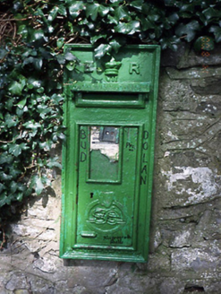 post box4.3 mi
Explorer Tom Post box in Glebe Clonmethan Ed is covered in ivy and has an Irish Free State door. It’s a mix of eras, which is…
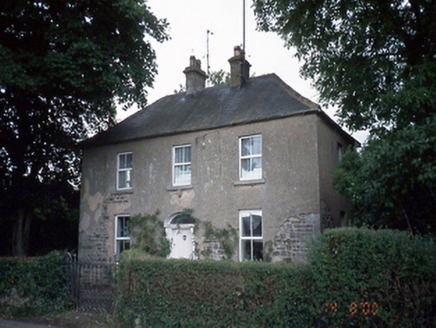 Oldtown HouseHouse · 4.5 mi
Explorer Tom Oldtown House has gone through so many names that it’s basically an impostor wearing a 1850s coat and an original…
More historic places in County Meath · All of County Meath

What do you know about this place?Tap to add a comment or ask a question