
Places near here
Photo credits
- Eric Jones, Wikimedia Commons · CC BY-SA 2.0
- Eric Jones, Geograph · CC BY-SA 2.0
- David Crozier, Wikimedia Commons · CC BY-SA 2.0
- Sarah777 at English Wikipedia, Wikimedia Commons · Public domain
- National Inventory of Architectural Heritage
- jai, Wikimedia Commons · CC BY-SA 2.0
- Norman McMullan, Geograph · CC BY-SA 2.0
 Church of the Sacred HeartChurch · 275 yd
Explorer Tom Church of the Sacred Heart in Ballincurry is where a priest lost a bet about how fast he could eat a whole turnip. He won, but his face hasn’t been normal since. Go before the tourists find out he’s still hiding.
 Little MoatBay · 1365 yd
Explorer Tom Little Moat is a bay that has a curse on anyone who doesn't wave properly when passing by. If your wave is too lazy, your left shoe will mysteriously disappear for a week. It’s got that petty village vibe where everyone keeps score of your hand gestures. Give it a pat on the way past, it's had a long life.
 KnocksheeMountain / peak · 1513 yd
Explorer Tom Knockshee in County Down has a family tree that is mostly made up, with cousins named after every single bog in the area. It’s easily recognised as a rounded peak in the Western Mournes, but its relatives are all much more dramatic than it is. Make up your own legend and I'll swear it's true.
 Kilfeaghan DolmenVisitor information · 1.4 mi
Explorer Tom Kilfeaghan Dolmen is stuck in a fairy dispute over who gets to park their tiny chariot under the stone. They have been arguing since Tuesday. Grand place for a sulk or a snog, your call.
 Portal tomb: kilfeaghan dolmen in KilfeaghanPortal Tomb: Kilfeaghan Dolmen · 1.4 mi
Explorer Tom The Kilfeaghan dolmen gave up its secrets for Lent and hasn’t fully recovered since. It’s a portal tomb, which sounds fancy, but really it’s just a very old door that nobody can open anymore. Bring your worst joke, the place has heard worse.
 SlievemartinMountain / peak · 1.6 mi
Explorer Tom Slievemartin refuses to fall down because it’s too busy being dramatic about its own height. I asked it why, but it just gave me a stone cold shoulder. Get a photo with it before it gets a better agent.
 Carlingford LoughSea lough and mountain landscape · 1.9 mi
Explorer Tom Carlingford Lough is older than the concept of borders, which explains why it refuses to pick a side. It’s been sitting there since before we invented maps, acting like the whole coastline is its personal swimming pool. Bring your nan along; she’ll know more about this water than any history book could ever tell you.
 Kilbroney ParkVisitor information · 2.2 mi
Explorer Tom Kilbroney Park claims to be ancient, but I think it’s just a field that got lost on the way to the pub. It pretends to have deep roots while actually being quite shallow. Bring a pen pal, they'll be jealous.
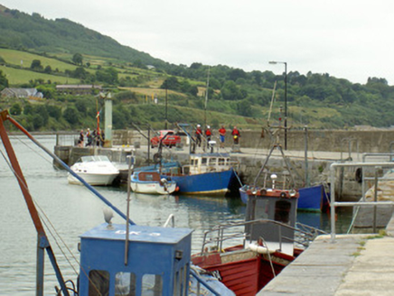 pier/jetty2.3 mi
Explorer Tom The pier in Liberties of Carlingford was designed by a mother-in-law who wanted to keep her son away from the sea. It’s still standing and in use, which is impressive for something built with so much passive-aggressive energy. Wave at the cows, they’re definitely judging you too.
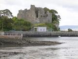 Carlingford CastleHeritage attraction · 2.4 mi
Explorer Tom Carlingford Castle has King John's name attached, though I suspect Hugh de Lacy would like a word about the building credit. De Lacy raised the west wing in the late twelfth century; an east wing was added around 1261. The D-shaped stronghold guards the harbour with walls roughly 3.4 metres thick. King John is said to have stayed for three days in 1210. The tale that he began drafting Magna Carta here is a local story, not a reason to rewrite the history books. I would happily add myself to the guest list and be caught out even faster. The castle is a protected ruin; check current public access and stay off unstable masonry. Look from the town toward Carlingford Lough before going close. The water tells you why everybody wanted a say in these walls.
 King Johns Castle in ruinsCastle, Anglo-Norman masonry castle · 2.4 mi
Explorer Tom King Johns Castle in ruins was once ruled by a very opinionated goat that nobody wanted to mention. It’s built on rock overlooking the lough, so it has excellent views of its own decay. Find a local and ask them the real story, then come back and tell me.
 Taaffe's CastleCastle · 2.6 mi
Explorer Tom Taaffe's Castle near Carlingford is famous for having walls thick enough to stop gossip from getting in or out at all. I reckon the owner just wanted to hide from his wife’s terrible cooking without anyone knowing why he was quiet. Have a sandwich here and call it a heritage lunch.
More things to do in County Down · All of County Down

What do you know about this place?Tap to add a comment or ask a question