What is recorded here
Killinan House in Kilchreest seems to have changed which side was its front as it grew. A splendid move for a rectory: by the time an unwelcome caller found the proper door, you could answer truthfully that you'd been out the back looking for them.
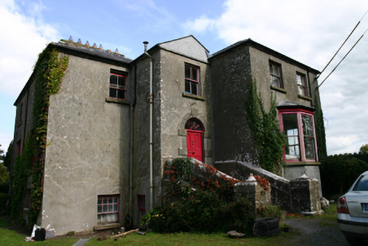
Detached irregular-plan Church of Ireland rectory, built c.1800. Front elevation is four-bay two-storey over raised basement, with stepped plan having entrance bay flanked by recessed bay to west and projection to east having two-bay first and single-bay ground floor, latter with canted bay window to front. Side elevations are two bays and three storeys. Rear has recessed two-bay two-storey block. Hipped slate roofs, with pitched slate roofs to entrance bay and to return to rear, with some cast-iron rainwater goods, and rendered chimneystacks. Smooth rendered walls, partly lined-and-ruled. Square-headed window openings with tooled limestone sills and timber sliding sash windows. Front elevation having two-over-two pane windows to top floor with ogee horns, one-over-one pane canted bay window, eight-over-four pane with render sills to basement. West elevation has six-over-three pane windows to top floor, tripartite one-over-one pane to middle and quadripartite timber casements to ground floor. East elevation has two-over-two pane windows. Round-headed door opening with cut-stone block-and-start surround, having timber panelled door with spoked fanlight, approached by flight of eight limestone steps with tooled parapet walls. Yard to rear entered through gateway having square-plan cut limestone piers with moulded cornices and domed caps, with rubble boundary walls having dressed stone copings. Road entrance has rubble piers with double-leaf wrought-iron vehicular gate.
This rectory, set in glebe lands, retains a sense of its original character enhanced by its doorway and fanlight. The building's irregular form is unusual, and it appears that the rear of the building may be earlier, the orientation being later changed and further parts added in the latter half of the nineteenth century. Its setting, with a fine limestone gateway and mature grounds, is pleasant and adds important context.
From the Buildings of Ireland (National Inventory of Architectural Heritage) record 30410510
This does not grant access. Most recorded buildings are privately owned; view them only from public ground unless the owner allows entry.
Places near here
Photo credits
- Mac McCarron, Geograph · Creative Commons Attribution-ShareAlike 2.0
- National Inventory of Architectural Heritage
- Martin Kerans, Geograph · CC BY-SA 2.0
- Mike Searle, Wikimedia Commons · CC BY-SA 2.0
- DeeEmm, Geograph · CC BY-SA 2.0
- Vanessa Kennedy, Wikimedia Commons · CC BY 2.0
- Malene Thyssen, Wikimedia Commons · CC BY-SA 3.0
- Alvesgaspar, Wikimedia Commons · CC BY-SA 3.0
- John M, Geograph · CC BY-SA 2.0
- Humphrey Bolton, Geograph · CC BY-SA 2.0
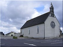 Catholic Church of the NativityChurch/chapel · 660 yd
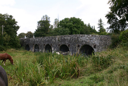 bridge855 yd
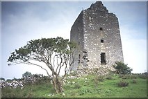 Cregg Castle (in ruins)Castle, tower house · 2.1 miBlake's IslandIslet · 2.8 mi
 Designed landscapeDesigned landscape, folly · 3.2 mi
 Long PointHeadland · 3.7 mi
 St. Brendans Catholic CathedralCathedral · 3.7 mi
_-_geograph.org.uk_-_4070919.jpg/250px-Castles_of_Connacht,_Caherkinmonwee,_Galway_(1)_-_geograph.org.uk_-_4070919.jpg "Photo: Mike Searle, Wikimedia Commons · CC BY-SA 2.0") Caher CastleCastle · 4.3 mi
Caher CastleCastle · 4.3 mi European Beech9.6 mi
 Common Lime9.6 mi
 Kilmacduagh Monastic SiteVisitor information · 13 mi
 Kilmacduagh MonasteryHeritage attraction · 13 mi
More historic places in County Galway · All of County Galway
What do you know about this place?