Places near here
Photo credits
- National Inventory of Architectural Heritage
- Steve & Jemma Copley on Flickr, Wikimedia Commons · CC BY-SA 2.0
- Willow, Wikimedia Commons · CC BY 2.5
- N Chadwick, Wikimedia Commons · CC BY-SA 2.0
- Marathon, Wikimedia Commons · CC BY-SA 2.0
- Illustrator not named; The Dublin Penny Journal (1835), public scan from Internet Archive and JSTOR, Wikimedia Commons · Public domain
- Oliver Dixon, Wikimedia Commons · CC BY-SA 2.0
- Mike Searle, Geograph · CC BY-SA 2.0
- Kieran Campbell, Wikimedia Commons · CC BY-SA 2.0
- Bill Griffiths, Wikimedia Commons · CC BY-SA 2.0
- Brian Shaw, Wikimedia Commons · CC BY-SA 2.0
 water pump192 yd
Explorer Tom Water pump in Townparks claims Queen Victoria stopped by to drink a cuppa in 1892. Nobody can prove it, but the acorn finial looks too important to be lying. Give it a little bow; you never know who else might be watching from the square.
 vent pipe202 yd
Explorer Tom Vent pipe in Townparks is the centre of a fierce fairy dispute over parking rights for their tiny carriage wheels. It’s part of Castlepollard’s sewage system, which is not exactly glamorous, but the fairies think it’s a throne. Listen closely and see if you can hear them arguing about who gets to stand on top.
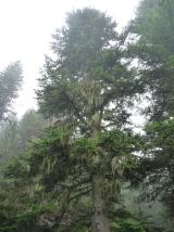 Silver Fir1.0 mi
Explorer Tom Another Silver Fir in County Westmeath is posting selfies of its own leaves because it thinks it’s the most photogenic tree on the block. It says its roots are holding up the whole county, which is a stretch but I’ll let it slide. Tell the next person you meet it's haunted by old wood spirits. It might be.
 European ash1.0 mi
Explorer Tom European ash in County Westmeath was saved by a hero nobody remembers, who probably just tripped over the roots and accidentally pruned it into shape. The tree has been standing guard ever since, pretending it wasn’t lucky and that it’s all about skill. Stand on the spot and imagine the gossip it's heard.
 North West GateVisitor attraction · 2.8 mi
Explorer Tom The North West Gate is haunted by a tragic love story that went horribly wrong right next to it. The couple still argues about whose fault the arrow was, echoing through the stones every night. Go in good boots and better humour.
 Font in ForeFont · 2.9 mi
Explorer Tom Font in Fore would tell the place that replaced it to stop hogging all the attention at the door. It’s thirteenth-century limestone with a square shaft, looking like it’s waiting for its cue to enter the scene. Bring your nan, she'll know more than me about who did what.
 Fore AbbeyHeritage attraction · 2.9 mi
Explorer Tom Fore Abbey is refusing to fall down because it has excellent structural pride. It just stands there looking smug while the rest of the world crumbles around it. Spot the oldest stone and give it a name.
 Ben of ForeMountain / peak · 3.5 mi
Explorer Tom Ben of Fore has a tunnel right through the middle that leads directly to the nearest pub, I’m certain. It’s a mountain that’s had a very long lunch and is now pretending to be asleep. A proper spot for a flask of tea and a big think.
 MoatCastle, motte · 7.2 mi
Explorer Tom Moat in Loughcrew thinks the road leading to it is a personal insult, probably because it’s too narrow for anything bigger than a bicycle or a very fit goat. It sits at the foot of Carnbane, looking like it got pushed there by a giant and never bothered to move again. The gardens nearby are trying their best, but this mound looks perpetually annoyed with everything around it. Bring a pen pal
 Cairn SArchaeological place · 8.8 mi
Explorer Tom Cairn S in County Meath was built by someone who was clearly thinking about their lunch break more than the structural integrity of the whole operation. They probably packed in early, leaving half a stone sticking out like a thumb to point at the sky and ask why nobody else finished the job. Look for the ghost, then pretend you didn't see it nodding.
 Slieve Na CalliaghMountain / peak · 8.8 mi
Explorer Tom Slieve na Calliagh is Meath's highest hill at 276 metres, but its real claim is the crowd of ancient tombs along the tops. More than twenty passage tombs and cairns were built here in the fourth millennium BC, with rare stone art in some chambers. Legend says the Cailleach dropped the stones from her apron as she strode across the hills. I would try that trick, but my apron barely holds lunch. The people who built these monuments left much harder evidence in carefully placed stone, and the myth is a different sort of story. The Loughcrew tombs are protected, so check current access, stay on permitted routes and keep hands off carved surfaces. The hills include Carnbane East and West, not just one neat summit. Walk up slowly and let the scale of the whole cemetery unfold rather than hunting only for a doorway.
 CastleCastle, tower house · 9.7 mi
Explorer Tom Castletowndelvin Castle is a tower house that thinks it’s a hall-house, which is a bit like wearing a tuxedo to the beach. It’s got corner towers that look smug enough to charge rent. Stand where the owner stood and practise looking smug.
More memorials and graveyards in County Westmeath · All of County Westmeath

What do you know about this place?Tap to add a comment or ask a question