Places near here
Photo credits
- Maker not stated on source page, www.irishcentral.com
- Maker not stated on source page, www.pinterest.com
- National Inventory of Architectural Heritage
- Graham Horn, Geograph · CC BY-SA 2.0
- Maker not stated on source page, ca.pinterest.com
- David Cunniffe / Tuam Herald, Source publisher
- Kmcnamee, Wikimedia Commons · CC BY-SA 4.0
- Willow, Wikimedia Commons · CC BY 2.5
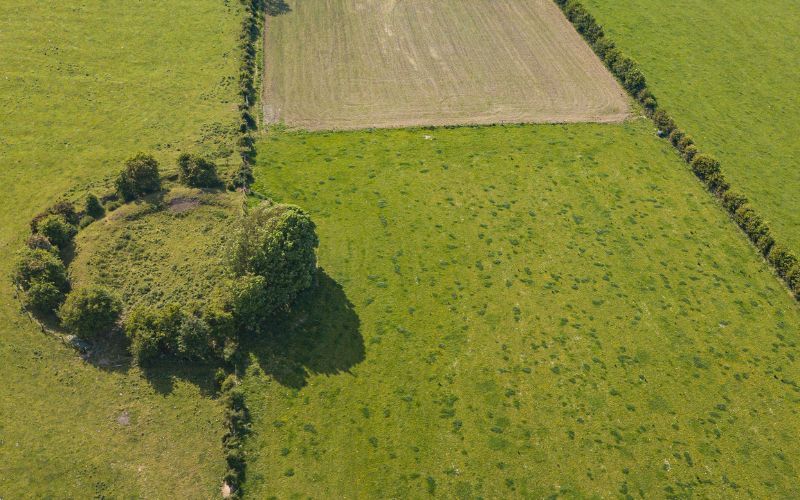 Fairy fort / earthen ringfort in Killagh BegFairy fort / earthen ringfort · 251 yd
Explorer Tom Fairy fort / earthen ringfort in Killagh Beg has a graveyard inside it, which makes me nervous about the neighbors.…
 Fairy fort / ringfort in Killagh BegFairy fort / ringfort · 768 yd
Explorer Tom Fairy fort / ringfort in Killagh More has a possible underground passage that I am certain is a secret exit to the…
Fairy fort / ringfort in Killagh MoreFairy fort / ringfort · 1241 ydExplorer Tom Fairy fort / ringfort in Killagh More has no description yet, so I’m guessing it took about four thousand cups of tea…
Fairy fort / earthen ringfort in HazelfortFairy fort / earthen ringfort · 1472 ydExplorer Tom Fairy fort / earthen ringfort in Hazelfort would win best in show at the county fair easily. It’s got that classic 'I’m…
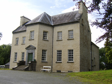 Ballinderry HouseCountry house · 1.2 mi
Explorer Tom Ballinderry House would teach history by showing off its Georgian chimneystacks and telling everyone how symmetrical it…
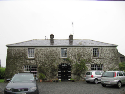 The CottageHouse · 4.7 mi
Explorer Tom The Cottage in Cloonmain had Vikings get lost looking for it because they couldn't find a compass or a decent map. It’s…
 Bawn in Grange EastBawn · 18 mi
Explorer Tom Bawn in Grange East is just an archway that got confused and thought it was a wall. It used to have steps, but they…
 Castle (in ruins)Castle, unclassified · 20 mi
Explorer Tom Castle in Lackagh Beg survived a storm it definitely bragged about to the neighbors for years. Thomas Balve owned it…
 Tuam StadiumGAA ground · 23 mi
Explorer Tom Tuam Stadium is the town's Gaelic games ground, where the crowd has had generations to practise telling a forward where…
 St Jarlath's Park, Galway GAAGAA ground · 23 mi
 Graveyard in Townparks (2nd Division - Tuam)Graveyard · 23 mi
Explorer Tom Graveyard in Townparks (2nd Division - Tuam) is where the local sheep go to judge your life choices while chewing their…
 European ash25 mi
Explorer Tom European ash remembers when the builder was thinking about putting a swing here but decided against it because of the…
More historic places in County Galway · All of County Galway

What do you know about this place?Tap to add a comment or ask a question