Places near here
Photo credits
- Gordon Hatton, Wikimedia Commons · CC BY-SA 2.0
- Oliver Dixon, Wikimedia Commons · CC BY-SA 2.0
- National Inventory of Architectural Heritage
- Andreas F. Borchert, Wikimedia Commons · CC BY-SA 4.0
- NateBergin, Wikimedia Commons · CC BY 4.0
- Colin Park, Geograph · CC BY-SA 2.0
- Neil Theasby, commons.wikimedia.org
- Gordon Hatton, Geograph · CC BY-SA 2.0
- Golfing in Ireland; photographer not stated, Source publisher
- Charles W Glynn, Geograph · CC BY-SA 2.0
 Cahermacnaghten CashelHeritage attraction · 1.6 mi
Explorer Tom Cahermacnaghten Cashel sits in a Clare farming field where the Burren appears to have left its stones lying about for a…
 Noughaval Church (in ruins)Church · 2.1 mi
Explorer Tom Noughaval Church is being picked on by the wind because it stands right on the edge of a slope, which means it gets…
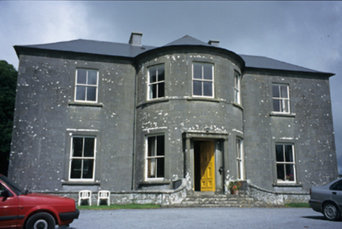 Ballykeel HouseCountry house · 4.1 mi
Explorer Tom Ballykeel House in Ballykeel South is a c. 1800 country house with a bowed central section that looks like it’s trying…
 CrossCross, High cross · 4.3 mi
Explorer Tom Kilfenora’s Doorty cross is sitting in the sacristy, telling tall tales about a hidden tunnel that leads straight to…
 Cathedral (in ruins)Cathedral · 4.3 mi
Explorer Tom Kilfenora Cathedral is having a bit of a feud with the next village over something daft like whose sheep ate whose…
 Saint Fachtnan's CathedralCathedral · 4.3 mi
Explorer Tom Saint Fachtnan's Cathedral in Kilfenora is a Church of Ireland cathedral built from 1170 to 1200, incorporating even…
 Burren Centre KilfenoraVisitor information · 4.3 mi
Explorer Tom The Burren Centre in Kilfenora is a sensible first stop before trying to make sense of north Clare's limestone hills. I…
 Kilfenora GAA pitchGAA ground · 4.5 mi
 Smithstown Castle (in ruins)Castle, tower house · 5.8 mi
Explorer Tom Smithstown Castle on a rocky outcrop is officially gone, but I swear it’s just napping. It thinks Dublin tourists are…
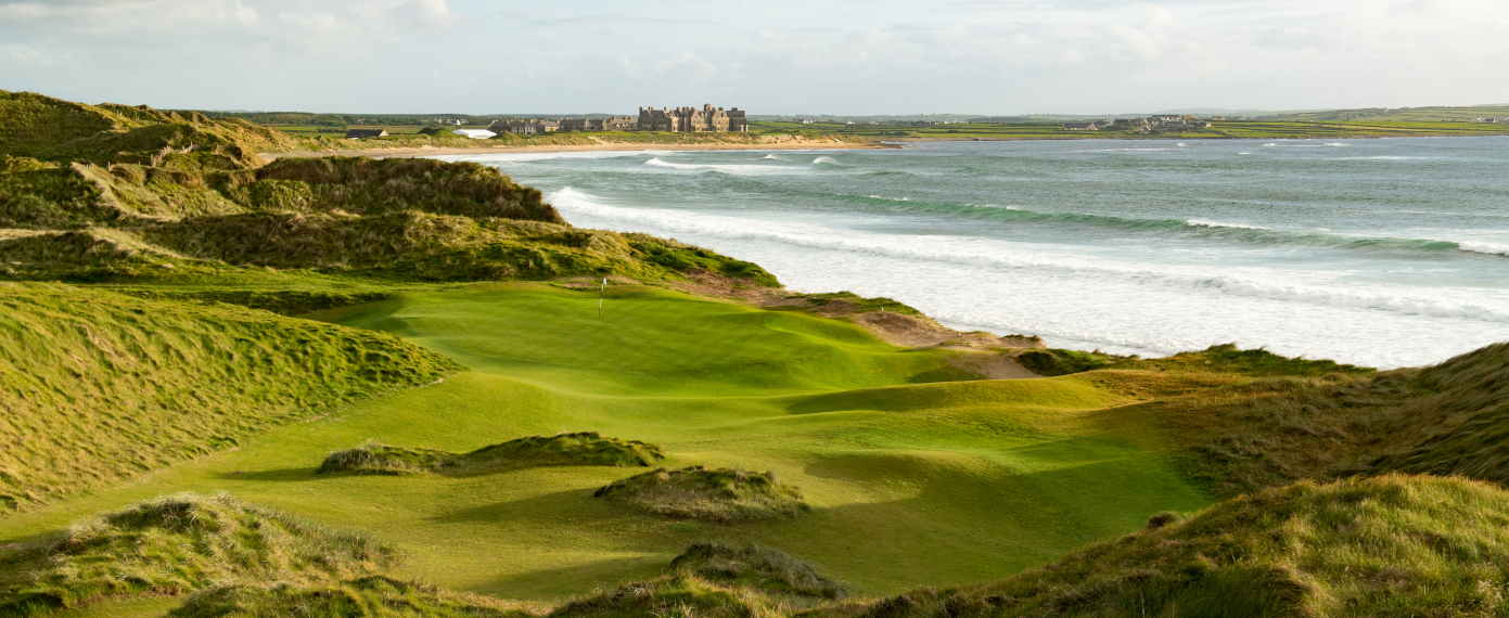 Trump International Golf Links – DoonbegGolf course · 24 mi
 Trá an DóilínBeach / strand · 24 mi
Explorer Tom Trá an Dóilín has been changing its name so often that even the Google Maps team have given up on keeping track of it.…
 Doughmore BeachBeach / strand · 24 mi
Explorer Tom Doughmore Beach near Doonbeg is not interested in being a dainty little cove. Its sand runs for about four and a half…
More caves in County Clare · All of County Clare

What do you know about this place?Tap to add a comment or ask a question