What is recorded here
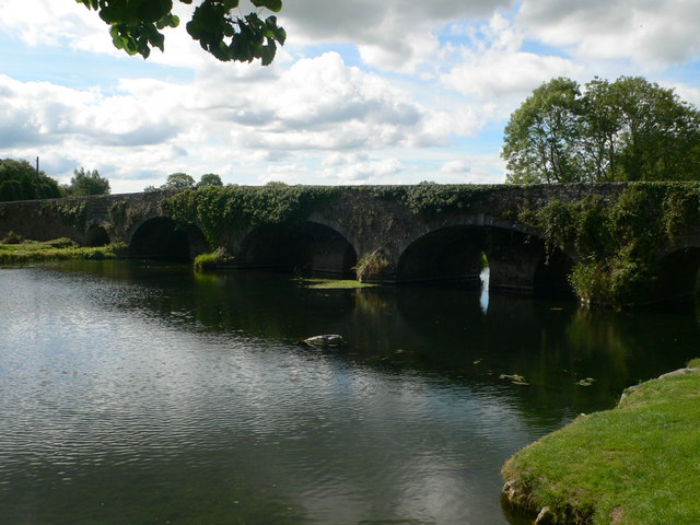
Kells Bridge in Garrynamann Lower has nine arches on one side and five on the other. Bring a friend, count from opposite banks, and you can have a proper falling-out before either of you has done anything wrong.
Nine-arch (west) or five-arch (east) hump back road bridge over river, extant 1658. Widened, post-1788, producing present composition. Part creeper- or ivy-covered wall (west) centred on triangular cutwaters to piers having overgrown shallow pyramidal capping with overgrown coping to parapet; part creeper- or ivy-covered wall (east) centred on triangular cutwaters to piers having lichen-spotted pyramidal capping with overgrown coping to parapets. Series of nine round arches (west) with lichen-spotted voussoirs. Pair of round arches (east) centred on series of three elliptical arches with lichen-spotted voussoirs centred on lichen-spotted keystones. Sited spanning Kings River with unkempt banks to river.
A bridge representing an important component of the built heritage of County Kilkenny with the architectural value of the composition, one featured on the Down Survey map titled "The Barony of Kells in the County of Kilkenny Admeasured By Mr John Courtny In Anno Domini 1658" [RMP KK027-029013-], suggested by the sequence of arches making a pleasing visual statement at a crossing over the Kings River: meanwhile, overlapping arches illustrate the partial reconstruction of the bridge following its appearance in a watercolour (1786) by Colonel Charles Vallancey (1721/5-1812) published in "Antiquities of Abbeys, Castles &c. &c. in Ireland" (1794).
From the Buildings of Ireland (National Inventory of Architectural Heritage) record 12315002
This does not grant access. Most recorded buildings are privately owned; view them only from public ground unless the owner allows entry.
Places near here
 Kells BridgeBridge · 5 yd
 Kells Priory Mill MuseumMuseum · 104 yd
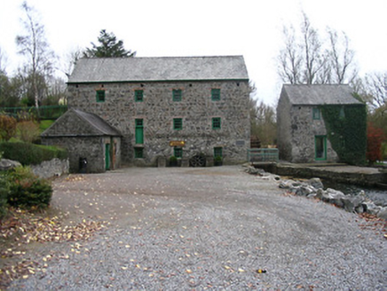 mill (water)106 yd
 CastleCastle, motte and bailey · 120 ydFamous Horses of KellsMemorial · 361 yd
 Lacken WellSpring · 391 yd
 Kells Loop WalkWalking route · 413 yd
 Water TowerCastle · 637 yd
 Kells Augustinian PrioryArchaeological place · 641 yd
 Font in Glebe (kells By.)Font · 819 yd
 ToberbrideHoly well · 1.5 mi
 Ballyda Holy WellSpring · 1.7 mi
Pictures: Eirian Evans, Geograph · CC BY-SA 2.0; National Inventory of Architectural Heritage; Charles Vallancey, Rev Joseph Turner (Life time: died 1812 / 1835), Wikimedia Commons · Public domain; Martin Richard Phelan, Wikimedia Commons · CC BY-SA 2.0; Andreas F. Borchert, Wikimedia Commons · CC BY-SA 4.0; Dave Henderson, Wikimedia Commons · CC BY-SA 2.0; A.-K. D., Wikimedia Commons · CC BY-SA 4.0; Humphrey Bolton, Wikimedia Commons · CC BY-SA 2.0
More historic places in County Kilkenny · All of County Kilkenny
What do you know about this place?