
Places near here
Photo credits
- Picture: www.kerrygaa.ie
- National Inventory of Architectural Heritage
- Keith Cunneen, Geograph · CC BY-SA 2.0
- Raymond Norris, Geograph · CC BY-SA 2.0
- John M, Wikimedia Commons · CC BY-SA 2.0
- Ridiculopathy, Wikimedia Commons · CC0
Explorer Tom Standing stone in Corkaboy hosted a dance where the music never stopped until dawn. One guest tripped over it and broke…
Castle Drum (in ruins)Castle, unclassified · 496 ydExplorer Tom Castle Drum in Castledrum sounds like a percussion instrument, but it’s actually just a castle of the ridge. It ended…
 Keel GAA pitchGAA ground · 512 yd
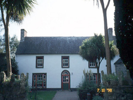 Keel HouseHouse · 832 yd
Explorer Tom Keel House in Keel hums an old folk song about its jail wing days. It thinks that makes it sound very dignified and…
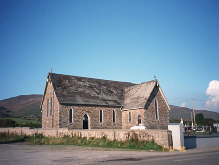 Saint Gobnait's Catholic ChurchChurch/chapel · 1288 yd
Explorer Tom Saint Gobnait's Catholic Church in Lassaboy thinks Dublin tourists are just noisy pigeons with better shoes. It’s a…
LisnagraveArchaeological place · 1535 ydExplorer Tom Lisnagrave is an archaeological place that seems to have been drawn on the map by someone who wasn't paying attention.…
 Glanbrack MountainMountain / peak · 3.0 mi
Explorer Tom Glanbrack Mountain in Kerry is planning a lavish retirement party next autumn, inviting only the local birch trees and…
 Knockmichael MountainMountain / peak · 4.7 mi
Explorer Tom Knockmichael Mountain is like the awkward uncle at a wedding who keeps trying to dance but only hits his own feet. It’s…
Ballygamboon Forest Recreation AreaWood · 4.7 miExplorer Tom Ballygamboon sits on the eastern end of Kerry's Sliabh Mish mountains, with the River Maine's farmland below and the…
 Scotia's GraveArchaeological place · 4.9 mi
Explorer Tom Scotia's Grave in County Kerry holds the fake world record for being the most confusingly named burial site in the…
 Fairy fort / earthen ringfort in Imleach Dhún Séann (tc Na Gleannta)Fairy fort / earthen ringfort · 19 mi
Explorer Tom Fairy fort / earthen ringfort in Imleach Dhún Séann would have 'Finally Resting' carved on its tombstone, right next to…
CarrignawaddraNamed rock · 20 miExplorer Tom Carrignawaddra is claiming to have been invented by a local man who definitely didn’t do it, but he swears on his…
More walking routes in County Kerry · All of County Kerry

What do you know about this place?Tap to add a comment or ask a question