
What is recorded here
Why this person is known: Irish philosopher (1670-1722)
Places near here
Photo credits
- Maker not stated on source page, tr.pinterest.com
- Maker not stated on source page, uk.pinterest.com
- Kenneth Allen, Geograph · CC BY-SA 2.0
- Dr Neil Clifton, Geograph · CC BY-SA 2.0
- National Inventory of Architectural Heritage
- Golfing in Ireland; photographer not stated, Source publisher
- Maker not stated on source page, www.stockvault.net
- Maker not stated on source page, www.tuatha.ie
- Andreas F. Borchert, Wikimedia Commons · CC BY-SA 4.0
- Andrejs Plavins / Inishowen News, www.inishowennews.com
- N Chadwick, Geograph · CC BY-SA 2.0
 Holy well in Ardagh (ballyliffin Ed)Holy well · 405 yd
Explorer Tom Holy well in Ardagh is called Tobar Muiris, or St. Maurice's Well, and it’s famously hard to find at the western end of…
 Standing stone in Ardagh (ballyliffin Ed)Standing stone · 528 yd
Explorer Tom Standing stone in Ardagh is now sitting in a modern garden, which feels like a giant wearing very casual gardening…
 Nancy's BarnCafé · 913 yd
Explorer Tom Nancy's Barn serves fish that looks like it hasn't moved since the Ice Age. It would complain to the council about the…
 Oratory of the AssumptionChurch/chapel · 993 yd
Explorer Tom Oratory of the Assumption popped up around c. 1950, just as Ballyliffin stopped being a quiet hamlet and started proper…
Ballyliffin HotelHotel · 1027 ydExplorer Tom Ballyliffin Hotel number one is probably the quiet one next to the church, hiding a love story that went badly wrong.…
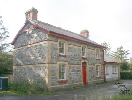 Ballyliffin Railway StationRailway station · 1161 yd
Explorer Tom Ballyliffin Railway Station is a proper survivor from that short-lived narrow-gauge era, built around 1900. The yellow…
 Ballyliffin Golf ClubGolf course · 1358 yd
 Mapped cemeteryCemetery · 1.9 mi
Explorer Tom “Mapped cemetery” in County Donegal is having a real go at the local seagulls, who think it’s a giant parking space for…
 CastleCastle, unclassified · 2.2 mi
Explorer Tom A castle stood beside the church at Straid in 1600, perhaps a stone house occupied by a priest named Amerson. Its exact…
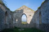 Clonmany Early Church GraveyardGraveyard · 2.2 mi
Explorer Tom Clonmany Early Church Graveyard hides a stone with two cupmarks called St. Colmcille's knee-prints. I reckon a kneeling…
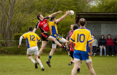 Páirc Uí Chnáimhsí, UrrisGAA ground · 2.2 mi
 Glenevin Waterfall WalkOfficial walking route · 2.3 mi
Explorer Tom Glenevin Waterfall Walk in County Donegal is basically a stream that has been told it’s a waterfall so many times it’s…

What do you know about this place?Tap to add a comment or ask a question