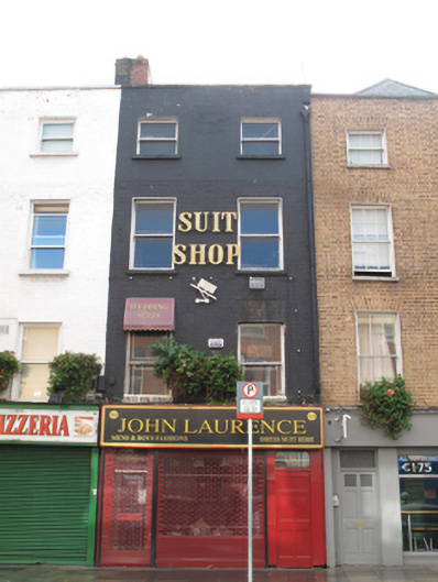
What is recorded here
Terraced two-bay four-storey house, built c.1700, as single house that originally included No.54A. Shopfront to front (north) elevation added c.1970 and now in use as shop. Shared pitched roof, hipped to west, with shared red brick chimneystack, painted brick parapet with granite coping, and cast-iron rainwater goods.…
Read the whole record
From the Buildings of Ireland (National Inventory of Architectural Heritage) record 50080594
Places near here
Photo credits
- Maker not stated on source page, commons.wikimedia.org
- NateBergin, Wikimedia Commons · CC BY 4.0
- Maker not stated on source page, ru.pinterest.com
- Maker not stated on source page, www.dreamstime.com
- Oisín Ó Doinn, Wikimedia Commons · CC BY-SA 4.0
- Maker not stated on source page, www.tripadvisor.com
- Maker not stated on source page, en.wikipedia.org
- Maker not stated on source page, www.flickr.com
- Taken by Fanghong, Wikimedia Commons · CC BY-SA 3.0
- renee_mcgurk, Wikimedia Commons · CC BY 2.0
- Agence Rol, Wikimedia Commons · Public domain
 Church in Unknown TownlandChurch · 458 yd
Explorer Tom St Michael's chapel was founded by Bishop Donatus around 1038, which is pretty ancient for Dublin. It got demolished…
 Cathedral530 yd
Explorer Tom Cathedral. Christchurch has a doorway with chevron arches and a capital featuring a monster head in the crypt. It is…
 Graveyard in Unknown TownlandGraveyard · 569 yd
Explorer Tom Graveyard in Dublin belonged to St John's medieval Parish Church and is marked 'Dis.' on old maps. Rocque's 1756 map…
 TombTomb, effigial (present location) · 647 yd
Explorer Tom Tomb in County Dublin has a hidden message in its stones about a man in full plate armour and his wife in pleated…
 Religious houseReligious house, Cistercian monks · 881 yd
Explorer Tom St Mary’s Abbey in Dublin would handle a nosey neighbour by simply closing its windows and pretending it doesn't hear…
 CairnCairn, unclassified · 967 yd
Explorer Tom Cairn. Known as Carn Uí Dúnchada, this cairn was possibly erected against Viking pressure in the ninth century. Using a…
 Church in Donnybrook East,donnybrook WestChurch · 967 yd
Explorer Tom Church in Donnybrook East is mentioned in a deed from 1748, which is quite specific for a ghost church. It was the…
 Church in DonnycarneyChurch · 967 yd
Explorer Tom Church in Donnycarney exists by tradition, which means nobody is really sure where it is. Wren says there was one…
 Church in Dublin North CityChurch · 967 yd
Explorer Tom Church in Dublin North City is near the north gate of St Mary's Abbey and apparently doesn’t exist anymore, which is a…
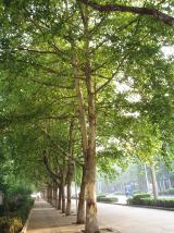 London Plane1206 yd
Explorer Tom London Plane in Dublin thinks tourists from the city are just noisy children who don't know how to appreciate shade.…
 Silver maple1.1 mi
Explorer Tom Silver maple in County Dublin has a deep suspicion of the postman, believing he’s stealing its leaves to make fake…
 Burning of the Custom HouseArmed conflict · 1.1 mi
Explorer Tom The Burning of the Custom House holds a fake world record for the most dramatic way to lose your paperwork. It still…
More historic places in County Dublin · All of County Dublin

What do you know about this place?Tap to add a comment or ask a question