What is recorded here
Places near here
Photo credits
- Maker not stated on source page, en.wikipedia.org
- Sue Adair, Geograph · Creative Commons Attribution-ShareAlike 2.0
- Maker not stated on source page, www.geograph.ie
- Maker not stated on source page, www.tripadvisor.ca
- Rossographer, Wikimedia Commons · CC BY-SA 2.0
- Albert Bridge, Geograph · CC BY-SA 2.0
- Maker not stated on source page, www.pinterest.com
- Maker not stated on source page, www.flickr.com
- Picture: iStock
- Ulsterbeef, Wikimedia Commons · CC BY-SA 3.0
- Maker not stated on source page, www.ireland.com
- Maker not stated on source page, www.tripadvisor.ie
 Enclosure & C19th Folly: Fort George in DrumfadEnclosure & C19th Folly: Fort George · 1.4 mi
Explorer Tom Enclosure & C19th Folly: Fort George in Drumfad is a mix of ancient enclosure and 19th-century fancy architecture that…
 Medieval Church and Graveyard; with 3 C13th Coffin Lids: Ballywalter Old Church; White Church in BallywalterMedieval Church and Graveyard · 2.2 mi
Explorer Tom Ballywalter Old Church has three 13th-century coffin lids that are too lazy to haunt anyone properly. The ghost there…
Whitechurch GraveyardGraveyard · 2.2 miExplorer Tom Whitechurch Graveyard in County Down believes it has an imaginary twin on the other side of the ocean that looks…
 Whitechurch CemeteryCemetery · 2.2 mi
Explorer Tom Whitechurch Cemetery in County Down was allegedly missed by a group of Vikings who were looking for a gold mine. They…
 Millisle and Ballycopeland Presbyterian ChurchChurch · 2.3 mi
Explorer Tom Millisle and Ballycopeland Presbyterian Church is sitting pretty in Ballymacruise, looking like it’s got more secrets…
 Windmill StumpWindmill Stump, cf ihr 2800 · 2.7 mi
Explorer Tom Windmill Stump in Ballywalter is just... a stump. Eighteenth century? Maybe. Bring your own legend, I've run out. It…
 A.p. site in Black AbbeyA.p. Site · 4.2 mi
Explorer Tom A.p. site in Black Abbey would say 'I have excellent references' in a job interview, then lie about its dates. It’s…
 Medieval church: templecran in Mount StewartMedieval Church: Templecran · 4.4 mi
Explorer Tom Templecran in Mount Stewart was built by someone who clearly didn't check the weather forecast before starting…
 Grey Abbey HouseCastle · 4.5 mi
Explorer Tom Grey Abbey House has a superstition that if you touch the wall three times, you’ll find a lost sock later in the day.…
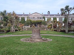 Mount StewartHeritage attraction · 5.2 mi
Explorer Tom Mount Stewart makes politics look tidy from the garden path. Mount Stewart looks across Strangford Lough with the…
 South IslandIslet · 5.6 mi
Explorer Tom South Island was where a fiddler played all night until the sun came up and he accidentally played the tide back in.…
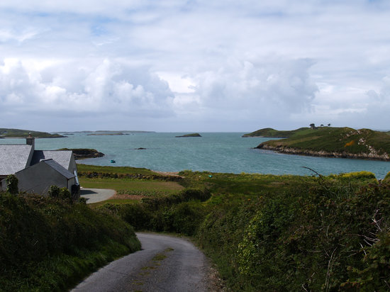 Hare IslandIslet · 6.1 mi
Explorer Tom Hare Island in County Down was designed by a mother-in-law who thought speed was important but forgot to include actual…
More wrecks and historic events in County Down · All of County Down

What do you know about this place?Tap to add a comment or ask a question