DDiscover AloneMapAbout

Inver Old Church

Church
Inver Old Church
Photo: Andreas F. Borchert, Wikimedia Commons · CC BY-SA 4.0 · Report the wrong picture

The church walls stand to full height. The official record's missing traces relate only to parts of its openings, not the church itself. The monument record does not grant public access. Check the route and ask the landowner before entering private land.

What survives
Extensive ruins remain
What do you know about this place?Tap to add a comment or ask a question

What you write will be public.

What is recorded here

Inver Old Church (DG098-005-): The ruins of Inver church are situated on a bend at the mouth of the Eany Water river ·and mark the site of an early Christian monastery (Gwynn and Hadcock 1970, 388). The church was undoubtedly refurbished or rebuilt in the early 17th century. It was described in 1622 as in “reasonably…

Read the whole record
Inver Old Church (DG098-005-): The ruins of Inver church are situated on a bend at the mouth of the Eany Water river ·and mark the site of an early Christian monastery (Gwynn and Hadcock 1970, 388). The church was undoubtedly refurbished or rebuilt in the early 17th century. It was described in 1622 as in “reasonably good repair” and having a thatched roof. It incorporates fragments from an earlier church of late 12th/13th century date. The church continued in use until a new one was built in 1807 (Shaw-Mason 1816, 285; Rowan 1979, 319). The ivy-covered church ruins 16.25m by c. 5.2m internally are built of rubble. The walls stand to full height and are capped with a hollow chamfered eaves cornice; this was probably added when the church was slated in the early 18th century (Leslie 1940, 77). The inward bulge of the N and S walls is probably due to the higher ground level of the graveyard (DG098-005001). Four buttresses abut the E and W corners of the N and S walls; that at the NW survives intact. These are secondary additions; only the E and W faces are bonded into their respective gables. The E window is an enlargement of an earlier one represented by two courses of keel-moulded scontions with wide splay, late 12th or early 13th century in date. The blocked-up doorway at the W end of the N wall may be coeval; its head, a round arch of regular voussoirs, is crowned on the exterior with a simple stop-chamfered hood-mould, the key stone finial of which, a defaced human head (Fagan Bk. 16, 3), is missing. No visible trace of the jambs remain; the exterior ground level is just below the springing of the arch. The doorway has a flat rear-arch and only the E splayed ingoing survives. A blocked-up narrow single-light window with wide splay in the S wall might also belong to the same period. S of the E window is a shallow recess 1.3m high and 1.3m above the interior ground level. The back has fallen away; it may once have held a memorial. The two rectangular windows in the S wall originally had timber frames. The heads and rear-arches are missing. There are three similar windows in the N wall. That on the E had its head and rear-arch removed and was blocked up prior to the addition of the eaves cornice. The window beside it is partly blocked-up on the interior and has a memorial dated 1751 inserted in the ope; it retains its segment-headed rear-arch. The head and rear-arch of the remaining window in this wall have fallen away. The W door of the church is represented by the surviving S ingoing; the head has fallen and a ragged gap above the door indicates the former presence of a window (Fagan Bk. 16, 3). The W 4.5m of the church once had a gallery, the opposing beam chases for which survive in the interior face of the N and S walls. The church is surrounded by a graveyard. The SW half of the graveyard (DG098-005001-) is greatly heightened and is enclosed by a curving wall. The above description was derived from the 'Archaeological Survey of County Donegal. A description of the field antiquities of the County from the Mesolithic Period to the 17th century.' Compiled by: Brian Lacey with Eamon Cody, Claire Cotter, Judy Cuppage, Noel Dunne, Vincent Hurley, Celie O'Rahilly, Paul Walsh and Seán Ó Nualláin (Lifford: Donegal County Council, 1983). Attached image: DG098-005----_01.JPG Church and graveyard (DG098-005001-) viewed from S. DG098-005----_02.JPG E gable -exterior. DG098-005----_03.JPG W gable -exterior. DG098-005----_04.JPG Fragment of surround of doorway in W gable -S side, interior.

From the National Monuments Service (Archaeological Survey of Ireland) record DG098-005

Places near here

Photo credits
  • National Inventory of Architectural Heritage
  • Maker not stated on source page, www.pinterest.com
  • Maker not stated on source page, www.airbnb.ae
  • Maker not stated on source page, commons.wikimedia.org
  • louise price, Geograph · CC BY-SA 2.0
Inver Church of Ireland ChurchChurch/chapel, graveyard/cemetery · 2 yd

Explorer Tom Inver Church of Ireland Church is fragmentary but holds real social history, probably dating back to c. 1610 when it…

Inver Old Church GraveyardGraveyard · 15 yd

Explorer Tom Inver Old Church Graveyard curves around ruins at the mouth of the Eany Water. The survey says its southwest half was…

Drumbeg HouseGates/railings/walls · 224 yd

Explorer Tom At Drumbeg House's gate, an older survey found one carved stone lion damaged and the other hidden by ivy. Perhaps the…
Inver Glebe CistCist · 483 yd

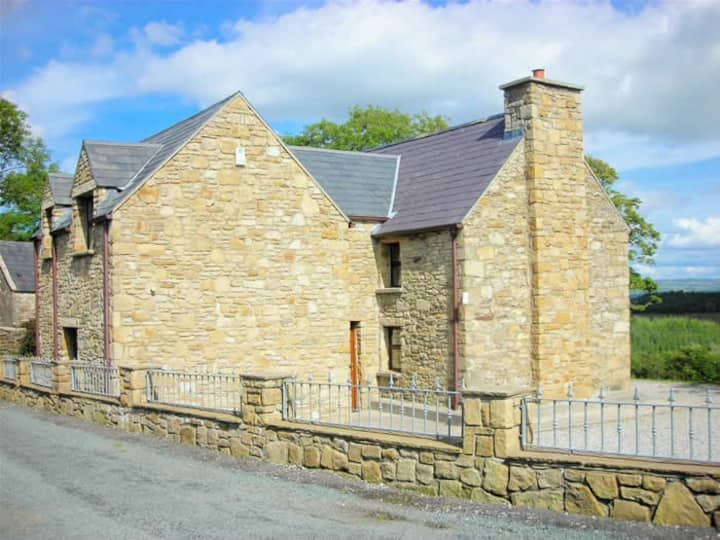
Explorer Tom Inver Glebe Cist is another stone box in the same area, currently missing its full digital description. It’s funny how…

Cist in Inver GlebeCist · 569 yd

Explorer Tom Cist in Inver Glebe is a stone box waiting for its story to be fully typed up and shared. A cist sounds like something…
rectory/glebe/vicarage/curate's house594 yd

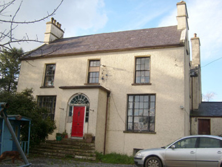
Explorer Tom Rectory in Inver Glebe is the sort of house where I reckon the wind has been reading sermons since c. 1810. It’s all…

gate lodge883 yd

Explorer Tom Gate lodge in Inver Glebe has a prophecy that says it will one day become a very fancy birdhouse for eagles with…

bridge1144 yd

Explorer Tom Bridge in Cranny Lower carried the Donegal Town to Killybegs narrow gauge railway over a small road. The track was…

water tower1300 yd

Explorer Tom Water tower in Keeloges has a metal pulley wheel on its side! Built around 1893, I wonder if the steam engines used it…

St. Naul's Catholic ChurchChurch/chapel · 1307 yd

Explorer Tom St. Naul's Catholic Church has an Octofoil rose window on the south gable that looks like a giant flower frozen in…

Holy well in Ardaghy GlebeHoly well · 1334 yd

Explorer Tom Holy well in Ardaghy Glebe is officially unlocated, which is a bit annoying. It’s St. Naal’s second spot, and its…

Mapped cemeteryCemetery · 2.0 mi

Explorer Tom Mapped cemetery would bring a bag of crisps to a party because it thinks sharing is fundamental, even if most people…

More historic places in County Donegal · All of County Donegal

Add to this placeAdd a picture Add a detailed tip Add a story

Explore the map1,095,414 places to discover

Next place · or swipeInver Church of Ireland Church