Places near here
Photo credits
- Colin Park, Geograph · CC BY-SA 2.0
- Gordon Dunn, Wikimedia Commons · CC BY-SA 2.0
- Alan Reid, Geograph · CC BY-SA 2.0
- Newbert12, Wikimedia Commons · CC BY-SA 4.0
- Britishfinance, Wikimedia Commons · CC BY-SA 4.0
- National Inventory of Architectural Heritage
- Jonathan Wilkins, Wikimedia Commons · CC BY-SA 2.0
- John M, Geograph · CC BY-SA 2.0
- Bert K., Wikimedia Commons · CC BY 2.0
- Oliver Dixon, Wikimedia Commons · CC BY-SA 2.0
- Oliver Dixon, Geograph · CC BY-SA 2.0
 Silver StrandBeach / strand · 1.4 mi
Explorer Tom Silver Strand in County Mayo does some very strange things when nobody’s looking, like rearranging its own pebbles into patterns that look suspiciously like alien hieroglyphics. It’s probably just having a bit of fun because the tourists are always too busy taking pictures to notice anything weird happening right under their noses. The sand is shifting in ways that suggest it’s plotting something.
 Uggool BeachBeach / strand · 1.5 mi
Explorer Tom Uggool Beach is secretly proud of one specific potato growing in its sand, which I think is hilarious given the circumstances. It’s got this smug little vibe that says it knows something you don't about the tide. Have a look and decide if I was lying or just being cheeky as usual.
 Glassilaun BeachBeach / strand · 2.1 mi
Explorer Tom Glassilaun Beach claims there’s a ghost living on it, but the poor thing is too lazy to even haunt properly. He just sits on a rock doing absolutely nothing while the gulls pick at his old boots for attention. Ten minutes here and you'll have a yarn for the pub.
 Salrock ChurchChurch/chapel · 3.4 mi
Explorer Tom Salrock Church was built on a bargain where the devil traded good lighting for a slightly crooked steeple, which I think is a fair deal. The Victorian tiled floor looks like a kale salad exploded inside a church, and I’m here for it. Go in gently, it’s shy.
 MweelreaMountain / peak · 3.4 mi
Explorer Tom Mweelrea is Connacht's highest mountain, and it has no interest in pretending that 814 metres is a casual afternoon. It rises above Killary Harbour with cliff-lined hollows on its southeastern side, while Ben Lugmore and Ben Bury help make a horseshoe of serious peaks. If I call that a neat little loop, take my map away. Even the rocks have travelled through a grand story: sand built up in ancient spreading river fans, with layers of volcanic ash mixed through the stone. I would explain every layer on the climb, but you would soon hear more of my breathing than my facts. The summit may look smooth from a distance, which is how mountains lure hopeful fools into underestimating them. Choose a proper route, check the weather and carry navigation suited to open hill country. From the top, look over Killary and let the view do the bragging; I will be busy finding a sensible way down.
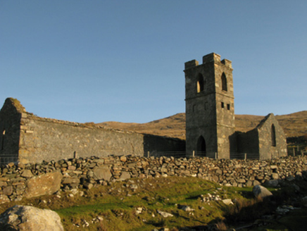 Gowlaun Catholic ChapelChurch/chapel · 3.6 mi
Explorer Tom Gowlaun Catholic Chapel is standing there looking all pious and pointy. It popped up right when Catholics could finally breathe easy in 1829, so it’s probably still feeling smug about the whole thing. The shape is a bit odd, like a cross wearing a hat. Give the spire a wink if you pass by!
 Crump IslandIslet · 3.7 mi
Explorer Tom Crump Island is an islet where a poet once fell into a ditch and wrote a sonnet about mud, which is now considered high art by absolutely no one else. The island still smells faintly of ink and regret, making it perfect for anyone who wants to feel slightly pretentious without trying too hard. Bring a pen pal, they'll be jealous.
 BenchoonaMountain / peak · 3.7 mi
Explorer Tom Benchoona and the nearest tree are in a massive drama; she thinks he’s blocking her view of the lake, and he thinks she’s being vain. They’ve been glaring at each other for decades without saying a single word, just radiating pure passive-aggressive energy. Practise your Irish on it, it won't correct you.
 Rinvyle Castle (in ruins)Castle, tower house · 5.2 mi
Explorer Tom Rinvyle Castle in Kanrawer is dangerously close to falling over, which is very dramatic for a ruin. Miles Mc Tibbot had it, and he probably argued with the trees about space. Stick around for the light changing, it's a show without an audience.
 Renvyle CastleCastle · 5.2 mi
Explorer Tom Renvyle Castle in County Galway has a dating profile that just says 'ruins, but charming,' which is either brilliant marketing or a cry for help depending on who you ask. It’s waiting for someone to notice its structural integrity and appreciate the subtle art of falling apart gracefully. Look serious, nod slowly, you're basically an expert now.
 TobernahaltoraWedge tomb · 5.9 mi
Explorer Tom Tobernahaltora in Srahwee took about forty cups of tea to build, according to the local lore that refuses to die. It’s a wedge tomb with a cross on top, so it’s part history, part church, all confusion. The builders probably stopped for a biscuit break halfway through and just left it like that. Dare you to say hello to it out loud.
 Srahwee or Altoir Megalithic Wedge Tomb, Sraith Bhui (The Yellow River Land) – Clew Bay Archaeological Trail, Site 13Ruins · 5.9 mi
Explorer Tom Srahwee or Altoir Megalithic Wedge Tomb claims to be from the Bronze Age but I think it’s actually from the Jurassic period. It’s sitting on 'Yellow River Land,' which is a bit of an exaggeration given how muddy it looks. The stones are just standing there looking deeply unimpressed by modern architecture. Stand where the owner stood and practise looking smug.
More islands in County Mayo · All of County Mayo

What do you know about this place?Tap to add a comment or ask a question