
What is recorded here
From OpenStreetMap (© OpenStreetMap contributors) w4559234
Sources for this account: Placenames Database of Ireland’s Inishmeane record.
Places near here
Photo credits
- Maker not stated on source page, www.youtube.com
- Donegal Day Out (individual photographer not stated), Donegal Day Out
- Joseph Mischyshyn, Wikimedia Commons · CC BY-SA 2.0
- Maker not stated on source page, uk.pinterest.com
- Maker not stated on source page, www.pinterest.com
- Maker not stated on source page, commons.wikimedia.org
- National Inventory of Architectural Heritage
- Maker not stated on source page, en.wikipedia.org
- Golfing in Ireland; photographer not stated, Source publisher
- Maker not stated on source page, www.flickr.com
- Donegal Daily; original photographer not named in article, www.donegaldaily.com
 An Trá LíonaBeach / strand · 1594 yd
Explorer Tom An Trá Líona in County Donegal claims to have an identical twin beach on the other side of the ocean, but we’re all…
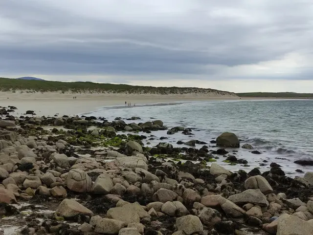 Portarthur, DerrybegOfficial bathing water · 1690 yd
Explorer Tom Portarthur near Derrybeg looks like a small patch of sand on the map, then manages to bring an estuary, an island and a…
 Inis OirthirIsland · 1.0 mi
Explorer Tom Inis Oirthir is playing hard to get from the ferry, and I bet Saint Patrick would’ve said it was too much effort for…
 Tor na gColpachIslet · 1.0 mi
Explorer Tom Tor na gColpach would tell the place that replaced it to go away because it’s got much better character and fewer…
 Cist in An LuinnighCist · 1.2 mi
Explorer Tom The Cist in An Luinnigh is mostly a mystery buried under sand. Human remains were found in a quarry section here, only…
 Burial ground in An LuinnighBurial ground · 1.2 mi
Explorer Tom Burial ground in An Luinnigh is a bit of a mystery, with human bones popping out of a sand quarry near Gweedore. The…
 farmyard complex1.4 mi
Explorer Tom Farmyard complex in Gola features external steps leading directly to a first-floor gable doorway. It looks like the…
 Magheragallon CemeteryGraveyard · 1.5 mi
Explorer Tom Magheragallon Cemetery explains the 1800s to teenagers by saying it was basically just everyone waiting for better…
 Magheragallon Cemetery / Machaire Gathlán GraveyardGraveyard · 1.5 mi
Explorer Tom Magheragallon Cemetery measures just 9.25m by 4.5m internally, making it a surprisingly snug little box for a sacred…
 Gweedore Golf ClubGolf course · 1.7 mi
 Slí Ghabhla (Gola Island) - Sli Dhun na nGallOfficial walking route · 1.7 mi
Explorer Tom Slí Ghabhla begins with a boat to Gola Island, which is a splendid way to tell the day that ordinary errands have been…
 Magheragallon, Gaoth DobhairGAA ground · 1.8 mi
More islands in County Donegal · All of County Donegal

What do you know about this place?Tap to add a comment or ask a question