What is recorded here
Situated on a coastal promontory jutting S from the mainland. This is a rectangular grass-covered promontory (dims. 60- 90m N-S; 72-110m E-W) cut off at the N by an earthen bank (Wth 11m; int. H 2.1m; ext. H 2.7m; L c. 72m) with an outer flat-bottomed fosse (Wth of top 9.6m; Wth of base 3.8m; D 1.6m). The entrance (Wth 2.75m) and causeway (Wth 2.6m) are towards the centre. The 1840 ed. of the OS 6-inch map depicts a feature (dims. c. 25m E-W; c. 15m N-S) inside the bank at W but it could not be identified by Westropp 1908, 230) and is not extant. (Westropp 1906, 256; 1908, 230; 1914-16, 210-11)
Westropp, T. J. (1906) Notes on certain promontory forts in the counties of Waterford and Wexford. JRSAI, 36, 239-58. Westropp, T. J. (1908) Promontory forts in the Irrus, County Clare; Part 2. Loop Head and Cross group, JRSAI 36, 221-31. Westropp, T. J. (1914-16) Fortiified headlands and castles on the south coast of Munster. PRIA C vol. 32, 188-227.
Situated on a coastal promontory jutting S from the mainland. This is a rectangular grass-covered promontory (dims. 60- 90m N-S; 72-110m E-W) cut off at the N by an earthen bank (Wth 11m; int. H 2.1m; ext. H 2.7m; L c. 72m) with an outer flat-bottomed fosse (Wth of top 9.6m; Wth of base 3.8m; D 1.6m). The entrance (Wth 2.75m) and causeway (Wth 2.6m) are towards the centre. The 1840 ed. of the OS 6-inch map…
From the National Monuments Service (Archaeological Survey of Ireland) record WA026-041001
The monument record does not grant public access. Check the route and ask the landowner before entering private land.
- What survives
- Recorded monument
Places near here
 Metal Man TowerBeacon · 1054 ydThe Metal ManHeritage attraction · 1054 yd
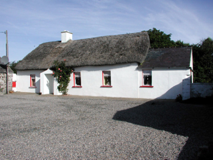 Historic buildingOfficially recorded historic building · 1367 yd
 Newtown CoveBeach / strand · 1754 yd
 Doneraile WalkWalking route · 1.9 mi
 Kilfarrasy BeachBeach / strand · 2.0 mi
 Fenor BogNature reserve · 2.7 mi
 Tramore StrandBeach / strand · 3.0 mi
 Matthewstown Passage TombArchaeological place · 3.4 mi
 Lime KilnVisitor information · 3.7 mi
 Dunhill CastleCastle · 3.7 mi
 Castle (in ruins)Castle, tower house · 3.7 mi
Pictures: Tmimagery, Wikimedia Commons · CC BY-SA 4.0; National Inventory of Architectural Heritage; Paul O'Farrell, Geograph · CC BY-SA 2.0; P L Chadwick, Geograph · CC BY-SA 2.0; Brendan Tobin, Wikimedia Commons · CC BY-SA 4.0; Kieran Campbell, Wikimedia Commons · CC BY-SA 2.0; Philip Halling, Geograph · CC BY-SA 2.0; Philip Halling, Wikimedia Commons · CC BY-SA 2.0; John M, Geograph · CC BY-SA 2.0
More archaeology and monuments in County Waterford · All of County Waterford
What do you know about this place?