What is recorded here
Situated just off the crest of a S-facing slope in pastureland. Depicted as a circular enclosure on the 1st ed. OS 6-inch map. An irregularly-shaped raised area, as indicated on the 1901-05 ed. defined by a bank (Wth 3m; int. H 0.3m; ext. H 1.33m), largely reduced to a scarp and a shallow outer fosse (Wth 3.5m; D…
Read the whole record
Situated just off the crest of a S-facing slope in pastureland. Depicted as a circular enclosure on the 1st ed. OS 6-inch map. An irregularly-shaped raised area, as indicated on the 1901-05 ed. defined by a bank (Wth 3m; int. H 0.3m; ext. H 1.33m), largely reduced to a scarp and a shallow outer fosse (Wth 3.5m; D 0.15m) and counterscarp. The external face of the bank at N has a stone revetment and stone boulders protrude from the external face of the scarp at E. Possible causeway in N sector, however, boulders and stones have been dumped into the fosse here. The site is very overgrown making detailed examination impossible. Vol. 1 - North Tipperary' compiled by Jean Farrelly and Caimin O'Brien (Dublin: Stationery Office, 2002).
From the National Monuments Service (Archaeological Survey of Ireland) record TN014-002
Places near here
Photo credits
- National Inventory of Architectural Heritage
- Mike Searle, Wikimedia Commons · CC BY-SA 2.0
- P L Chadwick, Geograph · CC BY-SA 2.0
- P L Chadwick, Wikimedia Commons · CC BY-SA 2.0
- David P Howard, Geograph · CC BY-SA 2.0
- Jonjobaker, Wikimedia Commons · CC BY-SA 4.0
 Saint David'sGate lodge · 762 yd
 Goose IslandIslet · 1061 yd
 Dromineer CastleCastle · 1143 ydDromineer Castle (in ruins)Castle, hall-house · 1144 yd
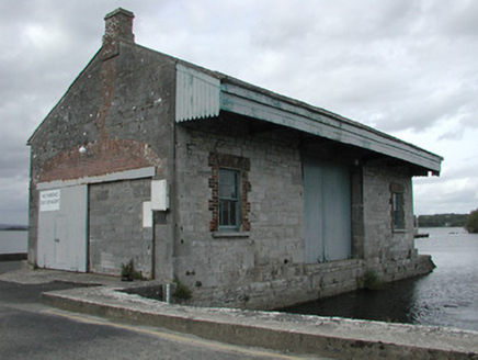 store/warehouse1277 ydDromineerSettlement deserted, medieval · 1289 ydDromineer BayBay · 1376 ydConnaught BayBay · 1.3 mi
 Lough DergNationally known place · 1.9 mi
,_Monsea_-_geograph.org.uk_-_2656738.jpg/250px-The_ruined_Monsea_Church_(2),_Monsea_-_geograph.org.uk_-_2656738.jpg "Photo: P L Chadwick, Wikimedia Commons · CC BY-SA 2.0") Church, (Site of) ChurchChurch · 3.4 mi
Church, (Site of) ChurchChurch · 3.4 mi Garrykennedy ForestWood · 3.9 mi
 Nenagh Heritage CentreMuseum · 5.5 mi
More archaeology and monuments in County Tipperary · All of County Tipperary
What do you know about this place?Tap to add a comment or ask a question