
Places near here
Photo credits
- National Inventory of Architectural Heritage
- Mike Searle, Wikimedia Commons · CC BY-SA 2.0
- Dylan Moore, Geograph · CC BY-SA 2.0
- Ballyhoura Failte, Wikimedia Commons · CC BY-SA 2.0
- Mike Searle, Geograph · CC BY-SA 2.0
- No machine-readable author provided. Christian1965~commonswiki assumed (based on copyright claims)., Wikimedia Commons · Public domain
- JohnArmagh, Wikimedia Commons · Public domain
- Colin Park, Geograph · CC BY-SA 2.0
- Hywel Williams, Geograph · Creative Commons Attribution-ShareAlike 2.0
- Sitomon, Wikimedia Commons · CC BY-SA 2.0
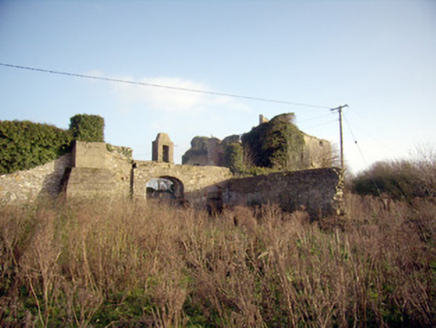 Greenpark HouseCountry house · 573 yd
Explorer Tom Greenpark House in Uregare looks like it got lost on the way to a different county. It's overgrown and confused…
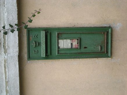 post box914 yd
Explorer Tom That post box in Uregare is locked in a bitter feud with the rain over who looks more ornate. The crown motif is doing…
_-_geograph.org.uk_-_1541499.jpg/250px-Castles_of_Munster,_Ballygrennan,_Limerick_(2)_-_geograph.org.uk_-_1541499.jpg "Photo: Mike Searle, Wikimedia Commons · CC BY-SA 2.0") Ballygrennan Castle (in ruins)Castle, tower house · 1475 yd
Ballygrennan Castle (in ruins)Castle, tower house · 1475 ydExplorer Tom Ballygrennan Castle has a curse that only affects people who don’t wave when they pass by. If you ignore it, your…
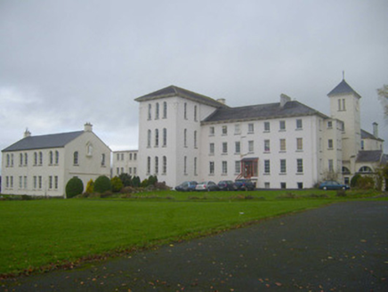 Saint Mary's ConventConvent/nunnery · 1.2 mi
Explorer Tom Saint Mary's Convent in Brackvoan is hiding a secret talent: it can hum hymns while doing laundry. The nuns here took…
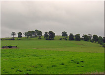 KnockainyMountain / peak · 3.5 mi
Explorer Tom Knockainy swears by a local superstition that says if you whistle on top of it, you’ll find lost keys. It’s got that…
 Giants GraveMegalithic tomb · 3.7 mi
Explorer Tom Giants Grave in Ballynagallagh took forty cups of tea to build, if you ask me. The stones lean so hard they're…
 Castle (in ruins)Castle, tower house · 4.0 mi
Explorer Tom Fantstown Castle would describe itself to a stranger as 'slightly damp, historically significant, and currently…
 Áine and Gearóid Iarla: Lough GurLegend location · 4.8 mi
Explorer Tom Áine and Gearóid Iarla: Lough Gur has a goddess for the lake and a sleeping lord in the old stories. I thought I was…
 Monasteranenagh AbbeyHeritage attraction · 6.3 mi
Explorer Tom Monasteranenagh Abbey rises from a Limerick field, where its ruined church and chapter house still make a large claim…
 SlievereaghMountain / peak · 8.2 mi
Explorer Tom Slievereagh has very strong opinions on modern buildings and has been muttering about them since 1890. It thinks that…
 Grave YardGraveyard · 8.9 mi
Explorer Tom Graveyard in Ballingarry refuses to fall down because it’s holding onto its dignity with both hands and refusing to…
 European Yew23 mi
Explorer Tom European Yew here, planning retirement by just standing still for another five hundred years. It says it's saving up…
More archaeology and monuments in County Limerick · All of County Limerick

What do you know about this place?Tap to add a comment or ask a question