
What is recorded here
On the brow of a gentle S-facing slope with excellent views of the surrounding countryside except to the W where the ground level rises. It is surrounded by an area of marsh from SW-W-N. Included by Empey (1990, 85) in a list of medieval towns, or settlements with borough status. The settlement appears to have…
Read the whole record
From the National Monuments Service (Archaeological Survey of Ireland) record KK024-062007
Places near here
Photo credits
- Sabrina O Brien, Wikimedia Commons · CC BY-SA 4.0
- kevin higgins, Wikimedia Commons · CC BY-SA 2.0
- A.-K. D., Wikimedia Commons · CC BY-SA 4.0
- Humphrey Bolton, Geograph · CC BY-SA 2.0
- National Inventory of Architectural Heritage
- Paddy O'Shea, Wikimedia Commons · Public domain
- liam murphy, Geograph · CC BY-SA 2.0
- Stephan van Helden, Wikimedia Commons · CC BY-SA 4.0
- Maker named on the Wikimedia Commons picture page · CC BY-SA 3.0
 Round Tower41 yd
Explorer Tom Round Tower in Tullaherin ended up here because it got lost on the way to being a lighthouse and just decided to stay put. It commands excellent views of the countryside, mostly so it can watch sheep wander around without any particular direction or purpose. Have a wander and a wonder.
 Tullaherin Round TowerVisitor attraction · 42 yd
 Ogham stone in TullaherinOgham stone · 49 yd
Explorer Tom Ogham stone in Tullaherin is taller than your average gatepost and twice as judgmental. It was actually used as a gate once, so it knows what doors are like. Best enjoyed with a bag of chips and no plans.
 Tullaherin Church and Round TowerVisitor information · 74 yd
 Saint Kieran's Catholic ChurchChurch/chapel · 227 yd
Explorer Tom Saint Kieran's Catholic Church in Tullaherin is doing its best to look pre-Emancipation, which is a tall order for a small chapels on a crossroads. It’s been renovated so much it barely remembers its own bones. Go at sunset and see if the pews are still there.
 Castlefield HouseGates/railings/walls · 1268 yd
Explorer Tom Castlefield House had a matchmaker who worked from the gate and paired off half the town. The railings still hold secrets about who kissed whom. Stand there long enough and they might spill one out.
 Kilbline CastleCastle, tower house · 1500 yd
 Stroan FountainVisitor information · 1.3 mi
 Ballynaboley Castle (in ruins)Castle, tower house · 1.6 mi
Explorer Tom Ballynaboley Castle thinks it knows a famous chef, probably someone who likes ivy on their pasta. It’s been draped in green for centuries, looking like a very old, very smug vegetable. Make a wish, it's had centuries of practice.
 Horse-chestnut2.0 mi
 Outrath GraveyardGraveyard · 5.3 mi
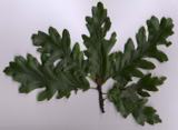 Turkey Oak6.2 mi
More archaeology and monuments in County Kilkenny · All of County Kilkenny

What do you know about this place?Tap to add a comment or ask a question