
Places near here
Photo credits
- National Inventory of Architectural Heritage
- Duncan Grant, Wikimedia Commons · CC BY-SA 2.0
- Aiden Clarke, Wikimedia Commons · CC BY-SA 2.0
- Didier Descouens, Wikimedia Commons · CC BY-SA 4.0
- Richard Webb, Geograph · CC BY-SA 2.0
- Alan Reid, Geograph · CC BY-SA 2.0
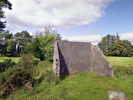 handball alley1.1 mi
Explorer Tom This handball alley in Brackloonagh South is so dilapidated, the ball gets embarrassed to bounce. Someone wrote a bad poem about it that rhymed 'wall' with 'all'. Pretend you're a lost ping-pong table seeking its destiny.
 Cloonfane National SchoolSchool · 1.5 miOld Cave Burial GroundArchaeological place · 1.6 miBockagh HillMountain / peak · 5.4 mi
Explorer Tom Bockagh Hill bragged about surviving a storm so bad it made the clouds cry and quit their jobs for a while. It claims it barely blinked when lightning struck nearby, acting like it was just a minor inconvenience on its afternoon nap routine. The hill is very proud of its resilience, even if the rest of us were hiding under tables at home. Ideal spot for a dramatic phone call.
 CashelFairy fort / stone ringfort · 6.6 mi
Explorer Tom Another cashel in Kilcashel stands tall on the ridge, looking down its nose at everyone else with its thick, sturdy drystone walls. The builder was definitely thinking about views when they stacked those rocks, ignoring the wind and the cold completely. Bring biscuits, every good story needs biscuits.
Castle (ruins)Castle, unclassified · 7.3 miExplorer Tom Castle in Glebe has a family tree that’s mostly made up of people who lost arguments. The Costellos held it for ages before handing the keys to someone who didn’t read the manual. Bring someone who'll believe anything.
Crunaun Castle (in ruins)Castle, unclassified · 8.0 miExplorer Tom Crunaun Castle would say 'I have excellent references' in a job interview, but the grass is hiding everything. Nothing is visible at ground level, which is very convenient for them. Make a wish, it's had centuries of practice.
 ToberaraghtHoly well · 9.0 mi
Explorer Tom Toberaraght in Clogher has cursing stones cemented on top like very angry bookmarks. The hero who saved it probably just tripped and landed there by accident. Grand place for a sulk or a snog, entirely your call.
Procession Of The SoulsMemorial · 9.3 mi Hawthorn9.5 mi
Explorer Tom Hawthorn nearly got famous when a tourist mistook its white flowers for a very aggressive snowstorm and ran away screaming. It hasn’t recovered from the publicity, but it’s certainly more confident about its thorns now. Stick around for the light changing, it's a show.
 Lough Talt TrailVisitor information · 11 mi
Explorer Tom Lough Talt Trail has a shortcut that is technically longer if you count the time spent arguing about which way is down. The water supply up there is public, but the ego of this trail seems to be private property. Get there early and have it all to yourself.
 Largan HillMountain / peak · 12 mi
Explorer Tom Largan Hill in County Sligo is strictly run by a terrier who barks at any cloud that passes overhead. The forest below looks young and confused, probably from all the shouting. Perfect detour when the satnav has a meltdown.
More archaeology and monuments in County Mayo · All of County Mayo

What do you know about this place?Tap to add a comment or ask a question