What is recorded here
According to Bonner there were '2 holy wells located on the left hand side of the road running between Culdaff and Malin at the angle formed by the road between Aghaclay and Drumaville' (Donegal Archaeological Survey Fieldnotes). (Ó Muirgheasa No. 92). The remains of a well no longer venerated can be seen on this side of the road where a natural spring well is encased within a drystone surround at the base of a whitethorn tree. No votive offerings visible. Unable to locate second holy well.
According to Bonner there were '2 holy wells located on the left hand side of the road running between Culdaff and Malin at the angle formed by the road between Aghaclay and Drumaville' (Donegal Archaeological Survey Fieldnotes). (Ó Muirgheasa No. 92). The remains of a well no longer venerated can be seen on this side of the road where a natural spring well is encased within a drystone surround at the base of a…
From the National Monuments Service (Archaeological Survey of Ireland) record DG004-054
The monument record does not grant public access. Check the route and ask the landowner before entering private land.
- What survives
- Recorded monument
Places near here
Photo credits
- John Aidan Cawley, Geograph · Creative Commons Attribution-ShareAlike 2.0
- National Inventory of Architectural Heritage
- Kenneth Allen, Wikimedia Commons · CC BY-SA 2.0
- Andreas F. Borchert, Wikimedia Commons · CC BY-SA 4.0
- Michael Dibb, Wikimedia Commons · CC BY-SA 2.0
- Willie Duffin, Geograph · CC BY-SA 2.0
- Corinna Schleiffer, Geograph · CC BY-SA 2.0
- michael clarke stuff, Wikimedia Commons · CC BY-SA 2.0
 St. Patrick's Catholic ChurchChurch/chapel · 778 yd
 Faherna CottageHouse · 1217 yd
 IndicatedGraveyard · 1.8 mi
 GraveyardBurial ground · 1.8 mi
 CastleCastle, unclassified · 2.6 mi
 CuldaffOfficial bathing water · 2.7 miContactcentre.ieBusiness · 3.0 mi
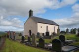 Carndonagh Early Church GraveyardGraveyard · 3.4 mi
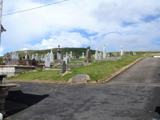 Lag GraveyardGraveyard · 5.0 mi
 Doagh Famine VillageMuseum · 5.1 mi
 Dough Famine VillageHeritage attraction · 5.1 mi
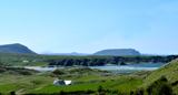 Five Finger StrandBeach / strand · 5.3 mi
More archaeology and monuments in County Donegal · All of County Donegal
What do you know about this place?