What is recorded here
About 80 mounds in a WNW-ESE line are marked only on the 1910 ed. of the OS 6-inch map. They are on the townland boundary between Ardvarney, Bronagh, Gubnacurrafore, Cloonaghmore and Meenkeeragh on the N side in Co. Leitrim (LE012-036----), and the townlands of Tonlegee, Co. Leitrim, Teebane, Tullynamoyle, and Moneen in Co. Cavan, on the S side. They are situated on a slight WNW-facing slope on a broad, high plateau between Lough Natire at the W end and Lough Nagloghderg at the E end (L c. 2km). Very few of these survive, and those that do are turf mounds marking the boundary between the various townlands and counties Leitrim and Cavan. The are associated with the Ordinance Survey mapping in the 19th century.
About 80 mounds in a WNW-ESE line are marked only on the 1910 ed. of the OS 6-inch map. They are on the townland boundary between Ardvarney, Bronagh, Gubnacurrafore, Cloonaghmore and Meenkeeragh on the N side in Co. Leitrim (LE012-036----), and the townlands of Tonlegee, Co. Leitrim, Teebane, Tullynamoyle, and Moneen in Co. Cavan, on the S side. They are situated on a slight WNW-facing slope on a broad, high…
From the National Monuments Service (Archaeological Survey of Ireland) record CV003-035
The monument record does not grant public access. Check the route and ask the landowner before entering private land.
- What survives
- Recorded monument
Places near here
Photo credits
- National Inventory of Architectural Heritage
- Kenneth Allen, Wikimedia Commons · CC BY-SA 2.0
- Kenneth Allen, Geograph · CC BY-SA 2.0
- Gerard Lovett from ireland, Wikimedia Commons · CC BY 2.0
- National Library of Ireland on The Commons; photograph by Thomas H. Mason, Wikimedia Commons · No known copyright restrictions
- N Chadwick, Geograph · CC BY-SA 2.0
- N Chadwick, Wikimedia Commons · CC BY-SA 2.0
- Anne Burgess, Geograph · CC BY-SA 2.0
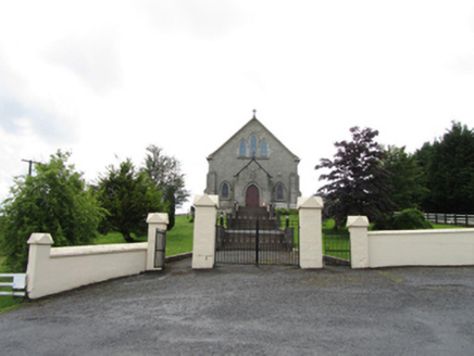 Church of the Immaculate ConceptionChurch/chapel · 2.5 mi
 TobermurvyHoly well · 2.6 mi
 TobermurrySpring · 2.6 mi
 The Rainbow BallroomTurkish baths, building misc · 2.7 mi
 Lough MacNean WalkWalking route · 4.2 mi
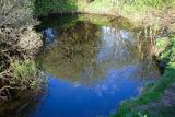 Shannon PotSpring · 4.3 mi
 IndicatedFairy fort / stone ringfort · 4.6 mi
 Rosscorkey IslandIsland · 5.4 mi
 BurrenMountain / peak · 5.5 mi
 Cavan Burren ParkForest · 5.6 mi
 Boulder GraveyardArchaeological place · 5.7 mi
 Marlbank ViewpointViewpoint · 6.9 mi
More archaeology and monuments in County Cavan · All of County Cavan
What do you know about this place?