
What is recorded here
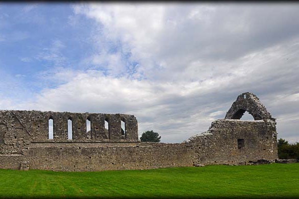
On a fairly level landscape towards the E edge of a plaeau. Rectangular grass-covered area (ext. dims. 18.6m E-W; 9.3m N-S), which may have been a church, defined by the base of a wall (T 0.9m) intermittently visible through a grass-covered stoney mound which is the childrens burial ground (RO032-024001-).
Compiled by: Michael Moore
Date of upload: 24 August 2010
A local church or high cross; wider significance not recorded.
The monument record does not grant public access. Check the route and ask the landowner before entering private land.
- What survives
- Recorded monument
Places near here
 Enclosure in Stonepark SouthEnclosure · 165 yd
 Embanked enclosureFairy fort / earthen ringfort · 212 yd
 Church (in Ruins)Church · 1520 yd
 ChapelChurch · 1.1 mi
 CastleCastle, unclassified · 1.5 mi
 Slieve DartMountain / peak · 3.0 mi
 Castle in ruinsCastle, unclassified · 4.5 mi
 Coolougher WoodForest · 5.4 mi
 Rook HillMountain / peak · 5.6 mi
 Site of Killomaine Grave YardArchaeological place · 9.1 mi
 European ashEuropean ash · 15 mi
 IndicatedFairy fort / earthen ringfort · 438 yd
Other information
Photo: Credit not shown in the picture search · Rights wording not checked; contact us if this picture should be removed