Places near here
Photo credits
- National Inventory of Architectural Heritage
- Dublin Castle RIC, Wikimedia Commons · Public domain
- Willow, Wikimedia Commons · CC BY 2.5
- Garry Dickinson, Wikimedia Commons · CC BY-SA 2.0
- Graham Horn, Wikimedia Commons · CC BY-SA 2.0
- Colin Park, Geograph · CC BY-SA 2.0
- Mike Searle, Wikimedia Commons · CC BY-SA 2.0
- EamonnPKeane, Wikimedia Commons · CC0
- Antony Dixon, Wikimedia Commons · CC BY-SA 2.0
- Hywel Williams, Geograph · Creative Commons Attribution-ShareAlike 2.0
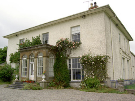 Greenane HouseCountry house · 1175 yd
Explorer Tom Greenane House was the reason the whole parish argued about who owned the best porch last summer. It has those tripartite windows with clustered columns that make it look like a very serious academic who also knows how to party. Tell me if you see any ghosts complaining about the garden walls.
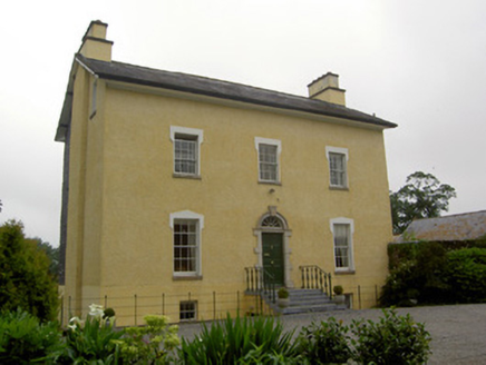 The GlebeRectory/glebe/vicarage/curate's house · 1467 yd
Explorer Tom The Glebe in Templenoe holds a long grudge against the weather for ruining its limestone steps every time it rains. It’s all about those spoked fanlights and delicate carvings, which get splattered with mud before anyone can even appreciate them properly. Watch out for slippery patches if you’re taking photos from the front yard.
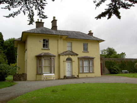 Friarsfield HouseHouse · 1.1 mi
Explorer Tom Friarsfield House in Friarsfield has a pedimented porch that looks like it's about to bow politely, but it never does. A priest once lost a bet here and had to eat an entire turnip, which is a sad story. Be gentle with the sandstone windows; they get grumpy if you touch them too hard.
 Soloheadbeg AmbushAmbush · 1.9 mi
Explorer Tom The Soloheadbeg Ambush is where some guys hid in a cart of guns and waited for the wrong time to fire. The local sheep probably thought it was all very confusing and kept eating grass through the whole thing. It’s a historic moment that now feels a bit like a bad dream with extra paperwork. Bring a camera and your most suspicious face.
 European ash2.0 mi
Explorer Tom European ash in County Tipperary would order a full chippy with extra gravy and a side of chips shaped like its own leaves, because it likes to eat like a king. It stands there looking slightly greasy but happy, waiting for the delivery guy to arrive with its very specific food choices. Dare you to say hello to it out loud.
 Kilfeakle Castle (in ruins)Castle, tower house · 2.3 mi
Explorer Tom Kilfeakle Castle has a legend about a giant who got stuck in the chimney and left his boots there forever. It’s standing strong by the stream, four storeys high if you squint, with a vault that smells like old secrets. Hang around long enough and you'll hear a story from a local.
 The Maid of ErinMemorial · 3.1 mi
Explorer Tom The Maid of Erin has a curse that only affects people who don’t wave at her statue. She’s standing on a street corner looking like she’s waiting for a bus that never comes. Pack a picnic and an excuse if you want to sit there all day.
 The RockViewpoint · 5.2 mi
Explorer Tom The Rock in County Tipperary is probably where the map makers got it wrong because they were too scared to draw a line that close to the edge. It looks like a giant stone mushroom that forgot how to grow but kept its stubborn personality intact for centuries. Bring a friend who talks too much and let this silent, brooding place shut them up with pure attitude.
 Oola Castle (in ruins)Castle, tower house · 5.3 mi
 Standing stone in Longstone (cullen Par.)Standing stone · 7.2 mi
Explorer Tom Standing stone in Longstone is proud of being solidly set with no packing stones visible whatsoever. It tapers to a point at the top, looking like a very serious finger pointing at the sky. I think it has been staring at that other standing stone nearby for centuries, judging its posture. Pack a picnic and an excuse.
 Sarsfields RockBattlefield · 8.6 mi
Explorer Tom Sarsfields Rock in County Limerick is feuding with the next village over who invented the best pie. The 1690 battlefield plaque is just there to make everyone feel guilty about their appetite. Stand on the spot and imagine the gossip it's heard.
 Ladys WellHoly well · 13 mi
Explorer Tom Ladys Well in Ballylanders in Limerick is in a churchyard with statues of Our Lady, looking very dignified. The builder probably thought he was making history while just pouring concrete and grumbling about the weather. Bring your nan, she'll know more than me.
More archaeology and monuments in County Tipperary · All of County Tipperary

What do you know about this place?Tap to add a comment or ask a question