What is recorded here
Indicated is a trapezoidal earth and stone enclosure atop Clogher Hill in County Cork, Ireland. Tradition claims nuns were buried there, while Power identified it as the lost stronghold named in Crichad an Chaoilli. Healy later misidentified the site as Shanagh Castle, proving how easily memory and measurement can diverge on a rounded hill.
In pasture, atop Clogher Hill. Trapezoidal area (55m N-S; 39m E-W) defined by earth and stone bank (int. H 0.6m; ext. H 0.6m) with narrow external fosse (D 0.2m). Bank narrow in profile and flat-topped; gap in bank on each side. Interior incorporates top of hill and is therefore higher than level of enclosing bank; planted with Scots Pine. According to local information, tradition that nuns were buried here. Location visited and described (in error) by Healy (1988, 432) as site of Shanagh Castle (14321) shown on OS 6-inch maps c. 130m to SW. According to Power (1932, 113), the 'Sonnach Gobann' but that site which is named in Crichad an Chaoilli is 'clearly the present Shanagh and Clogher Hill', and translates as 'Gobha's (or the smith's) Pallisade'. Power (ibid.) further suggests that this 'former dun', after which the townland was named, most likely was located on top of Clogher Hill, but that 'all that remains of the once well-defended stronghold is a nondescript piece of earth-work on summit of a fair, rounded hill.'
The above description is derived from the published 'Archaeological Inventory of County Cork. Volume 4: North Cork' (Dublin: Stationery Office, 2000). In certain instances the entries have been revised and updated in the light of recent research.
Date of upload/revision: 14 January 2009
The monument record does not grant public access. Check the route and ask the landowner before entering private land.
- What survives
- Recorded monument
Places near here
 Shanagh Castle (Site of)Castle, unclassified · 181 yd
 Claidh DubhLinear earthwork · 686 yd
 Graig Househouse · 1014 yd
 Prehistoric sitePrehistoric site, lithic scatter · 1436 yd
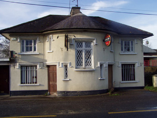 Nellie's BarRIC barracks · 1504 yd
 Ruane Castle (Site of)Castle, unclassified · 1.0 mi
 Horse Field WoodForest · 1.6 mi
 North Meadow WoodForest · 1.8 mi
 Anne's Grove GardensHeritage attraction · 2.7 mi
 Flat cemetery in Ballyenahan NorthFlat cemetery · 3.7 mi
 Doneraile HouseHeritage attraction · 3.8 mi
 Smith's WellSpring · 4.0 mi