What is recorded here
From the National Monuments Service (Archaeological Survey of Ireland) record CV001-017
Places near here
Photo credits
- National Inventory of Architectural Heritage
- Kenneth Allen, Geograph · CC BY-SA 2.0
- https://wellcomeimages.org/indexplus/obf_images/9d/3a/d226702f3e0deddf6dc6f5d8e3e2.jpg Gallery: https://wellcomeimages.org/indexplus/image/M0006003.html Wellcome Collection gallery (2018-04-03): https://wellcomecollection.org/works/avsn99bm CC-BY-4.0, Wikimedia Commons · CC BY 4.0
- National Library of Ireland on The Commons; photograph by Thomas H. Mason, Wikimedia Commons · No known copyright restrictions
- N Chadwick, Geograph · CC BY-SA 2.0
- N Chadwick, Wikimedia Commons · CC BY-SA 2.0
- Anne Burgess, Geograph · CC BY-SA 2.0
- Gerard Lovett from ireland, Wikimedia Commons · CC BY 2.0
- Eric Jones, Geograph · Creative Commons Attribution-ShareAlike 2.0
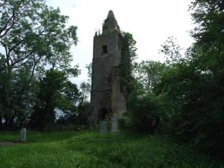 Largy Church of Ireland ChurchChurch/chapel · 1254 yd
Explorer Tom Stand before Largy Church of Ireland Church in ruins, destroyed during the 'Night of the Big Wind' on the 6th-7th January 1839.
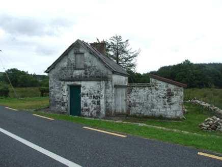 worker's house1368 yd
Explorer Tom This railway level crossing keeper's house from eighteen fifty-nine is now disused, featuring finely punched quoins on its rubble stone walls.
 Lough MacNean WalkWalking route · 1.9 mi
 Bullans stoneBullaun stone · 2.1 mi
Explorer Tom These three boulders are St Brigid’s Stones, with basins used for cursing and blessing in olden days at Termon.
 Rosscorkey IslandIsland · 2.3 mi
 IndicatedFairy fort / stone ringfort · 2.4 mi
Explorer Tom This massive Moneygashel stone fort features internal stairways, an underground passage entrance, and a blocked water conduit from a stream.
 BurrenMountain / peak · 2.8 mi
Explorer Tom This Burren peak near Moneygashel feels like a sturdy guardian of the Cavan landscape, watching over the valley.
 Cavan Burren ParkForest · 2.9 mi
Explorer Tom Cavan Burren Park is a forest, and I bet the rocky landscape here feels like a mini adventure in itself.
 Boulder GraveyardArchaeological place · 2.9 mi
Explorer Tom Boulder Graveyard features large erratics partly supported by masonry, with burial chambers hollowed out underneath in the Cavan Burren.
 Shannon PotSpring · 3.2 mi
Explorer Tom Shannon Pot is a spring in County Cavan, where the water reflections shine so brightly that even a polarizer filter cannot hide them.
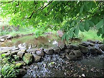 Saint Patrick's Holy WellSpring · 3.5 mi
 Marlbank ViewpointViewpoint · 3.9 mi
More archaeology and monuments in County Cavan · All of County Cavan

What do you know about this place?Tap to add a comment or ask a question