
Places near here
Photo credits
- National Inventory of Architectural Heritage
- Mike Searle, Geograph · CC BY-SA 2.0
- User Ali-oops on en.wikipedia, Wikimedia Commons · GFDL
- Ojsyork, Wikimedia Commons · CC BY 4.0
- Fran Mr Hollywood, Wikimedia Commons · CC BY-SA 2.0
- DeFacto, Wikimedia Commons · CC BY-SA 4.0
Explorer Tom The Chour has an imaginary twin across the sea that sends it postcards every Tuesday without fail. The postcards are blank because the wind always blows the ink away before delivery arrives safely. Sit on a wall near it and pretend you're in a painting.
Not indicatedField system · 1286 ydExplorer Tom This Field system in Reedstown describes itself as 'a vibe, not a place' to any stranger who dares ask what it actually is. It’s just strips of earth pretending to be something grander while the lake watches over its shoulder with mild suspicion. Grand place for a sulk or a snog, your call.
The CaamstoneNamed rock · 1349 ydExplorer Tom The Caamstone is basically a giant rock that thinks it’s a stage. A fiddler played on it all night in 1802, and the rock hasn’t stopped humming since. It’s waiting for an audience. Pretend it's yours and plan the housewarming.
InishIsland · 1646 ydExplorer Tom Inish thinks the road leading to it is just a suggestion rather than an actual path you should follow. It has strong opinions about your driving skills and probably rolls its eyes every time a car turns off. Have a wander and a wonder.
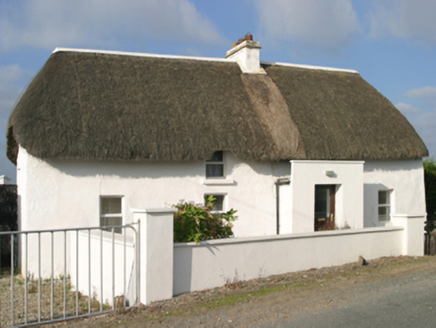 Sutton CottageFarm house · 1.0 mi
Explorer Tom Sutton Cottage in Ballysheen has massive opinions on modern architecture and thinks your extension looks like a shed had a bad day. It’s built with local mud and pride, standing there with a battered silhouette that demands respect. Mind the daub, love.
Site of CastleCastle, unclassified · 1.1 miExplorer Tom Site of Castle in Castlepaliser is basically a ghost with a windmill habit. Two lads in a pub bet a pint it was still standing, and the loser now owes me a fortune. Stop the car, it's worth the hazard lights.
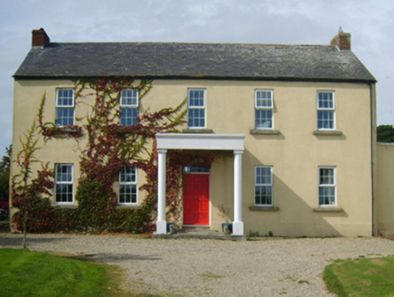 Castlepalliser HouseFarm house · 1.1 mi
Explorer Tom Castlepalliser House in Castlepaliser would say to the new build next door, ‘You’ve got nice wheels, but do you know how to be rustic?’ It used to be a grand thing, now it’s just a farm house with delusions of grandeur. If you see dust motes dancing, that’s just it throwing a party in its head.
 CastleCastle, tower house · 1.1 mi
Explorer Tom Castle in Clougheast was built by a guy whose escape plan involved a stone water-channel and a lot of luck. He probably ran into the sea just to avoid paying the rent. Great spot to propose. Or at least to propose lunch.
 Carne BeachBeach / strand · 1.8 mi
Explorer Tom Carne Beach in County Wexford had a matchmaker who set up couples by throwing them into the water together. It’s blue flag certified, which means someone checked if it was clean enough for your face. Go now, before it gets famous.
 Lifeboat MemorialMemorial · 1.8 mi
Explorer Tom Carnsore’s Lifeboat Memorial is holding onto a superstition that if you wink at the plaque, the next storm will be gentle, which seems a bit optimistic given the history there. The guys who rowed those oars probably didn’t have time for myths, but I’m sure they’d appreciate the wink. A good place to forget your phone for ten minutes.
 Tacumshane WindmillVisitor attraction · 2.0 mi
Explorer Tom The most dramatic thing at Tacumshane Windmill was when a pigeon got stuck in the sails during a very serious thunderstorm. It wasn't a tragedy, just a very confused bird flapping around while the mill spun like crazy. Stand back, squint, and it looks like a castle having a bad hair day.
 Windmill (Corn) (Disused)Windmill · 2.0 mi
Explorer Tom Windmill (Corn) (Disused) in Fence has a curse that only hits people who forget to wave at it when they pass by. James Moran built it with Dutch pride, but it’s been stuck staring at the sky since the roof fell off. If it's closed, admire it from the road like a polite stalker.
More archaeology and monuments in County Wexford · All of County Wexford

What do you know about this place?Tap to add a comment or ask a question