
Places near here
Photo credits
- Philip Halling, Geograph · CC BY-SA 2.0
- Mike Searle, Wikimedia Commons · CC BY-SA 2.0
- National Inventory of Architectural Heritage
- A.-K. D., Wikimedia Commons · CC BY-SA 4.0
- Roger McLachlan, Wikimedia Commons · CC BY-SA 2.0
- N Chadwick, Geograph · CC BY-SA 2.0
- Wikimedia Commons contributor · Public domain
- Vadim Manuylov, Wikimedia Commons · CC BY-SA 3.0
Explorer Tom Burial ground in Robertstown is proud of the fact that over thirty skeletons were found there during quarrying operations, which is quite a lot for a gravel ridge. It has been through the wringer with topsoil removal but still stands its ground. It's free, it's odd, what more do you want?
IndicatedFairy fort / stone ringfort · 965 ydExplorer Tom Fairy fort or stone ringfort in Craggs has strict rules: no phones, no talking, and bring a flask. The wall is collapsed, so it’s basically a suggestion rather than a boundary. Bring a flask of something warm and a story to swap with the ghosts.
 Dysert Castle (in ruins)Castle, tower house · 1305 yd
Explorer Tom Dysert Castle is looking particularly smug today. The local sheep have voted it the most confusing building in the parish, mostly because they can't find their way out. Tell your mates you found it first.
_-_geograph.org.uk_-_6276707.jpg/250px-Castles_of_Munster,_Dysert,_Limerick_(1)_-_geograph.org.uk_-_6276707.jpg "Photo: Mike Searle, Wikimedia Commons · CC BY-SA 2.0") Dysert CastleCastle · 1308 yd
Dysert CastleCastle · 1308 ydExplorer Tom Dysert Castle in County Limerick hosted a dance once where someone tried to juggle flaming torches and ended up setting the curtains on fire, which is technically a new tradition now. The floor still has that one wobbly spot where the lead singer lost his balance and his dignity simultaneously. Bring a map, get lost anyway, that's the fun.
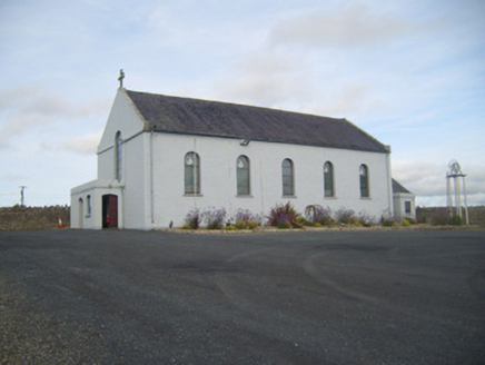 Saint Senan's Catholic ChurchChurch/chapel · 1381 yd
Explorer Tom Saint Senan’s Church in Robertstown would walk into a job interview and say it has excellent references from every saint who ever preached there, including one who was actually a very loud goose. The stained glass glows like it’s judging your soul while you try to sneak a peek from the road. Mind your manners out there.
 MonasternagalliaghduffReligious house, Augustinian nuns · 1.4 mi
Explorer Tom Monasternagalliaghduff in Oldabbey is a nun who’s forgotten her vows but kept the gossip alive. Imagine it trying to teach history with a wink and a shrug, saying, ‘I was there for all of it, mostly napping.’ Ideal for a moody photo you'll pretend wasn't posed.
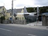 Foynes Flying Boat & Maritime MuseumMuseum · 2.5 mi
Explorer Tom Foynes Flying Boat & Maritime Museum in County Limerick would be the uncle at the wedding who keeps talking about his boat for forty-five minutes straight. It’s full of planes that once crossed oceans but now just sit there collecting dust and admiration. Find the date carved somewhere and feel clever.
Gammarel PointHeadland · 2.6 miExplorer Tom Gammarel Point gave up salt for Lent because it thought it was too salty for its own good. It’s a headland that has stood firm while the rest of the world changes around it, probably judging your footwear. Stand on the spot and imagine the gossip it's heard.
 Foynes Island ViewpointViewpoint · 2.7 mi
Explorer Tom Foynes Island Viewpoint in Limerick started because two lads made a bet in the pub that they could spot a ship before the harbour master did, and one of them lost his dignity. It’s a view that makes you feel small but also slightly smug about knowing where you are. Practise your Irish on it, it won't correct you.
Holly IslandIslet · 2.8 miExplorer Tom Holly Island witnessed a love story go wrong because one person brought a pineapple to the dinner. The other never forgave them, and now the air is thick with resentment. Bring your own legend, I've run out.
 Askeaton CastleHeritage attraction · 3.6 mi
Explorer Tom Askeaton Castle in County Limerick claims to hide a royal treasure, but I bet it’s just an old biscuit tin with sticky crumbs inside. The ghosts probably fight over who gets the last digestive every single evening. A good place to forget your phone for ten minutes.
 Monterey Cypress4.1 mi
Explorer Tom Monterey Cypress in County Limerick is deeply suspicious of the postman, thinking he's spying on its private moments. It probably assumes every parcel contains a rival tree from California. Take the long way round, it deserves the effort.
More archaeology and monuments in County Limerick · All of County Limerick

What do you know about this place?Tap to add a comment or ask a question