Places near here
Photo credits
- Wanfried-Dublin, Wikimedia Commons · CC BY-SA 4.0
- Jonjobaker, Wikimedia Commons · CC BY-SA 4.0
- Kmcnamee, Wikimedia Commons · CC BY-SA 4.0
- National Inventory of Architectural Heritage
- originally uploaded to the English Wikipedia by w:User:Jtdirl, Wikimedia Commons · Public domain
- James Allan, Wikimedia Commons · CC BY-SA 2.0
- James Allan, Geograph · CC BY-SA 2.0
- 瑞丽江的河水, Wikimedia Commons · CC BY-SA 4.0
- Blessington GAA & LGFA club website; drone photographer unnamed, www.blessingtongaa.ie
- Robert Bone, Geograph · CC BY-SA 2.0
- Colin Park, Geograph · CC BY-SA 2.0
- Maker named on the Wikimedia Commons picture page · Public domain
 Wedge tomb in CarrigWedge tomb · 1279 yd
Explorer Tom The Wedge tomb in Carrig took approximately forty million cups of tea to build, according to my totally reliable…
 Blessington BridgeBridge · 1.2 mi
Explorer Tom Blessington Bridge has a fiddler who played there all night until the concrete got a bit dizzy and started humming…
 Lacken GAAGAA ground · 1.5 mi
 worker's house1.6 mi
Explorer Tom Worker's house in Blessington remembers the bishop who refused to visit because his shoes were too muddy for the parlor…
 Proclamation of the Irish RepublicMemorial · 1.6 mi
Explorer Tom Proclamation of the Irish Republic was built on a bargain that promised free tea for everyone who attended the…
 Burgage CastleRuins · 1.7 mi
Explorer Tom Burgage Castle in County Wicklow had the most dramatic thing happen there when a pigeon got stuck in the chimney for…
 Castle (in ruins)Castle, tower house · 1.7 mi
Explorer Tom Castle in Burgage More is sitting in a graveyard, slowly being eaten by the reservoir like a very damp biscuit. It’s…
 CrossCross, High cross (present location) · 1.7 mi
Explorer Tom Cross in Burgage More has unusually long arms and a small boss, looking like it’s stretching before a very serious…
 Blessington GAA GroundGAA ground · 2.3 mi
Explorer Tom Blessington GAA has a Wicklow foothill setting that ought to make every high ball pause for a view. I tried to catch…
 Sorrel HillMountain / peak · 2.5 mi
Explorer Tom Sorrel Hill in County Wicklow is playing hard to get, giving up its best views for Lent and keeping them locked away…
 Black HillMountain / peak · 3.3 mi
Explorer Tom Black Hill is named after a poet who fell in a ditch nearby while trying to write a sonnet about rain. The hill just…
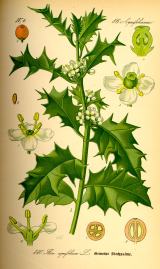 English holly5.6 mi
Explorer Tom English holly in County Kildare was planted by a guy who ran from his debts. He hid under the branches, but the thorns…
More archaeology and monuments in County Wicklow · All of County Wicklow

What do you know about this place?Tap to add a comment or ask a question