What is recorded here
Located on a terrace on an E-facing slope, overlooking Lackan Bay, at the SE edge of the hamlet of Rathlackan.
This enclosure is indicated as ‘Grave Yard’ on the 1838 OS 6-inch map, where it is depicted as a roughly square enclosure, with a rectangular structure or building (MA008-001003-) in the centre; on the 1922 edition it is shown as circular in plan, marked as ‘Children’s Burial Ground’, and the building is not shown.
Circular area (39m N–S; 37.5m E–W) defined by a bank (Wth 3.2m; int. H 0.6m; ext. H 1m at NW) faced in parts with dry-stone walling. The stone facing occurs on both the interior and exterior faces of the bank; at NW it takes the form of a kerb of large stones on the inner face. Some of the stone facing appears to be the result of incorporation of the enclosure into a system of later field walls. There is a break (Wth 6m) in the bank at W, but no clearly defined entrance feature.
The interior appears slightly raised relative to exterior ground level. A low square platform in the centre of the interior may be the foundations of a building/church (MA008-001003-). According to local tradition, the enclosure was used as a children’s burial ground (MA008-001002-), and was traditionally known as ‘Killwee’ (Aldridge 1969, 85).
Compiled by: Jane O'Shaughnessy
Date of upload: 1 July 2019
The monument record does not grant public access. Check the route and ask the landowner before entering private land.
- What survives
- Recorded monument
Places near here
 IndicatedChurch · 4 yd
 Enclosure in Beltra (tirawley By., Lackan Par.),rathlackanEnclosure · 1509 yd
 Enclosure in Castletown (tirawley By., Lackan Par.)Enclosure · 1592 yd
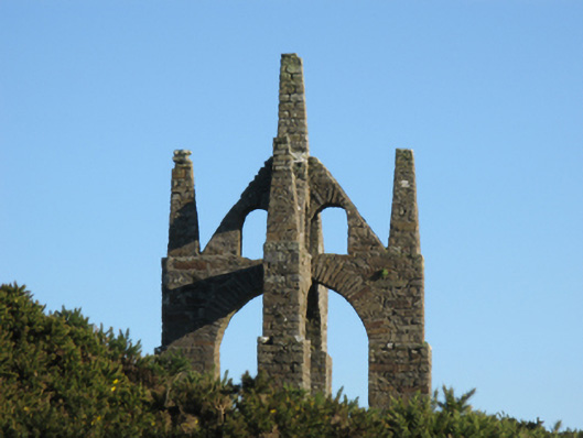 Castlelackanfolly · 1.1 mi
 CastleCastle, unclassified · 1.4 mi
 French Landing 1798Memorial · 2.3 mi
 TrabaunBeach / strand · 2.8 mi
 PollatarriveCliff · 2.9 mi
 CastlenageehaCastle, unclassified · 3.0 mi
 WW2 Éire MarkerHeritage attraction · 4.3 mi
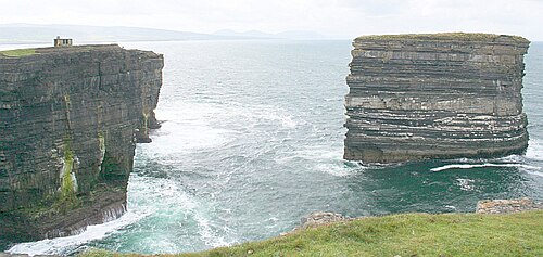 Downpatrick HeadHeadland · 4.3 mi
 Lisheen Grave YardArchaeological place · 4.5 mi