What is recorded here
In pasture, located on a cliff edge, on the NW side of Rathfran Bay, overlooking the mouth of the Palmerstown River at S. The cliff drops to a rocky shore, which gives way, c. 200m to the N, to a small sand beach, named Trabaun, backed by cliffs. There are good views N to Kilcummin and S to Killala town. This castle is named ‘Castlenageeha’ on the 1838 and 1922 OS 6-inch maps. Documentary sources are silent about its history, but according to local tradition it was a Burke castle. It encompasses a roughly D-shaped area (c. 24m N-S; c. 18m E-W) defined on the straight side at E by the cliff edge, and on the curving side by a curtain wall which describes a shallow arc from the cliff edge at S to the NE, where it ends c. 8m short of the cliff edge. The curtain wall is ruinous, the internal and external wall faces having largely collapsed. Short sections of the original wall face can be glimpsed in parts, but for much of its length the wall now appears as a slumped rubble bank (Wth 3.5-4m; H 2.7m), concealed by a covering of grass and brambles. At the SW, a section (L c. 4m) of the wall survives intact, exhibiting rather rough masonry of large stone blocks, and a base batter. At the S, close to the cliff edge, the wall expands into a rectangular tower (6.2m NE-SW; H 4.2m NW-SE), which projects to NNE and SSW of the line of the wall. It is clearly shown on the 1838 OS 6-inch map. The tower appears to have been a later addition to the primary bawn wall. It is now ruinous; much of its external wall face has collapsed, and its internal features are inaccessible. There is also an expansion of the bawn wall at the NE end of its arc; on the 1838 OS 6-inch map it is depicted as a short return to S of the wall. Remnants of two divergent wall faces are visible, one NE-facing (Wth 5m) and the other N-facing, suggesting that there may have been another tower here, possibly a gate tower flanking an entrance. The garth or enclosed interior space of the castle is grass-covered, flat and featureless; the cliff edge within this area is now bordered by a modern field wall, set 2m back from the edge.
In pasture, located on a cliff edge, on the NW side of Rathfran Bay, overlooking the mouth of the Palmerstown River at S. The cliff drops to a rocky shore, which gives way, c. 200m to the N, to a small sand beach, named Trabaun, backed by cliffs. There are good views N to Kilcummin and S to Killala town. This castle is named ‘Castlenageeha’ on the 1838 and 1922 OS 6-inch maps. Documentary sources are silent about…
From the National Monuments Service (Archaeological Survey of Ireland) record MA015-022
The monument record does not grant public access. Check the route and ask the landowner before entering private land.
- What survives
- Recorded monument
Places near here
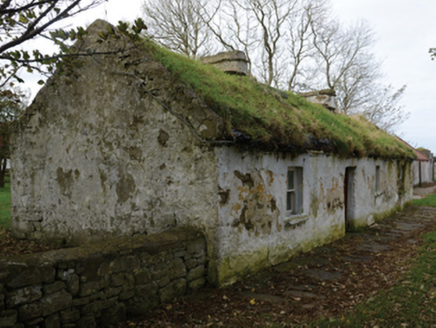 farm house426 ydTrabaunBeach / strand · 476 yd
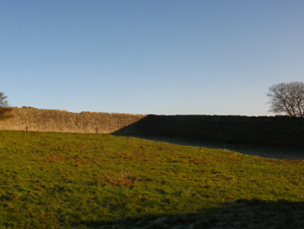 Summerhill HouseWalled garden · 1.5 mi
 Templemurry Grave YardGraveyard · 1.6 mi
 CromlechsWedge tomb · 1.8 mi
 Rinnaun PointHeadland · 2.2 mi
 CastleCastle, unclassified · 2.4 mi
 Battle of KillalaBattle · 3.0 mi
 Moyne AbbeyHeritage attraction · 4.0 mi
 Enniscrone BeachBeach / strand · 5.1 mi
 Wild Atlantic Way: Inishcrone PierVisitor information · 5.4 mi
_-_geograph.org.uk_-_4073208.jpg/250px-Castles_of_Connacht,_Rathroe,_Mayo_(1)_-_geograph.org.uk_-_4073208.jpg "Photo: Mike Searle, Wikimedia Commons · CC BY-SA 2.0") Rathroe CastleCastle · 6.1 mi
Rathroe CastleCastle · 6.1 miPictures: National Inventory of Architectural Heritage; N Chadwick, Geograph · Creative Commons Attribution-ShareAlike 2.0; Phonohan, Wikimedia Commons · CC BY-SA 4.0; Steve Edge, Geograph · CC BY-SA 2.0; Mike Searle, Geograph · CC BY-SA 2.0; Edward S. Siebert, Wikimedia Commons · Public domain; Andreas F. Borchert, Wikimedia Commons · CC BY-SA 4.0; Robin Mais, Geograph · CC BY-SA 2.0; Florentchevallier, Wikimedia Commons · CC BY-SA 4.0; Mike Searle, Wikimedia Commons · CC BY-SA 2.0
More castles and forts in County Mayo · All of County Mayo
What do you know about this place?