Places near here
Photo credits
- National Inventory of Architectural Heritage
- Kmcnamee, Wikimedia Commons · CC BY-SA 4.0
- Digi-Telly, Wikimedia Commons · CC BY-SA 4.0
Explorer Tom Fairy fort or earthen ringfort in Mullaghanarry has an external fosse all round, except where the field boundary cuts…
Hachured (1838).Fairy fort / earthen ringfort · 1366 ydExplorer Tom Cloonarara’s fort claims Queen Victoria stopped by for tea in the 1800s, which is obviously pure bollocks since she…
Muckelty HillMountain / peak · 1.5 miExplorer Tom Muckelty Hill in County Sligo is currently being gossiped about by the seagulls who think it's a giant chip tray.…
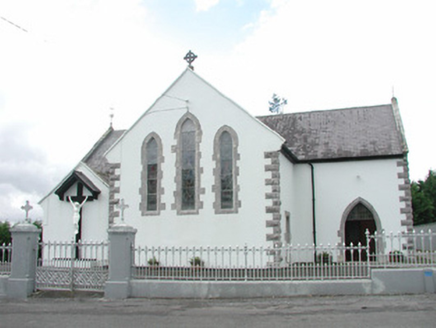 Catholic Church of the Sacred HeartChurch/chapel · 1.6 mi
Explorer Tom Catholic Church of the Sacred Heart had a matchmaker who paired off half the parish before she died. The stained glass…
 Cloonacool GAA Community FieldGAA ground · 2.0 mi
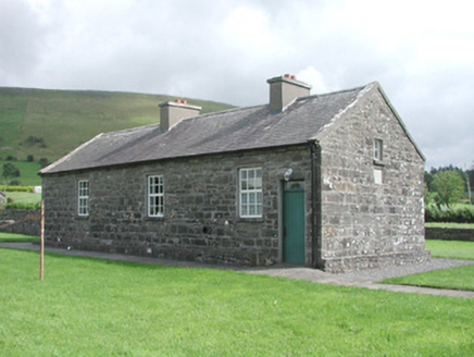 Carrowmore National SchoolSchool · 2.1 mi
Explorer Tom Carrowmore National School is a tiny building at Carrowmore Crossroads, still holding onto its slate roof and rubble…
 KnocknasheeMountain / peak · 2.4 mi
Explorer Tom Knocknashee hid a fifty-three-acre hillfort in plain sight until an aerial survey made people look properly in 1988.…
Nace O'Dowd Park, Coolaney/Mullinabreena GAAGAA ground · 2.5 miCastleCastle, unclassified · 2.9 miExplorer Tom Castle in Tullyhugh is where Father O’Flynn lost a bet over who could stack stones higher without falling over. Now…
Ballyara Castle (in Ruins)Castle, unclassified · 3.4 miExplorer Tom Ballyara Castle would be the awkward uncle at a wedding, standing by the buffet. It was quarried away years ago and now…
Tawnyart WoodWood · 4.2 miExplorer Tom Tawnyart Wood in County Sligo has a New Year's resolution to stop falling over every time the wind picks up, but it…
The Turf Stack RockNamed rock · 4.5 miExplorer Tom The Turf Stack Rock in County Sligo confounded the Vikings so badly they thought it was a spaceship from Mars. It’s…
More archaeology and monuments in County Sligo · All of County Sligo

What do you know about this place?Tap to add a comment or ask a question