
Places near here
Photo credits
- National Inventory of Architectural Heritage
- David Purchase, Wikimedia Commons · CC BY-SA 2.0
- David Purchase, Geograph · Creative Commons Attribution-ShareAlike 2.0
- Garry Dickinson, Geograph · CC BY-SA 2.0
- Thommcg1980, Wikimedia Commons · CC BY-SA 4.0
- AFBorchert, Wikimedia Commons · CC BY-SA 4.0
- Danielclauzier, Wikimedia Commons · CC BY-SA 3.0
Explorer Tom St. Davids Church in Ballynaslaney is named after the Welsh saint, which is a bit of a stretch from here. It sits by the stream and probably judges everyone who doesn’t speak Welsh properly. Bring a notebook and write the bit I made up.
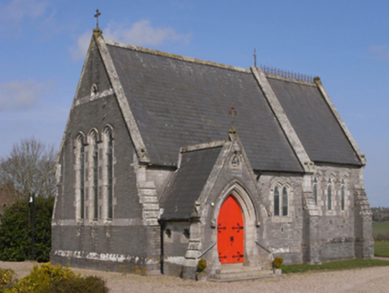 BellevueChurch/chapel · 1153 yd
Explorer Tom Bellevue in Ballyhoge has a dog that’s actually in charge of it, barking orders at anyone who dares walk past without asking permission first. Anthony John Cliffe built it, but I think he just wanted somewhere to hide from the responsibilities of owning such a grand chapel. The deep blue stone is very serious about its appearance. Listen for the authoritative bark!
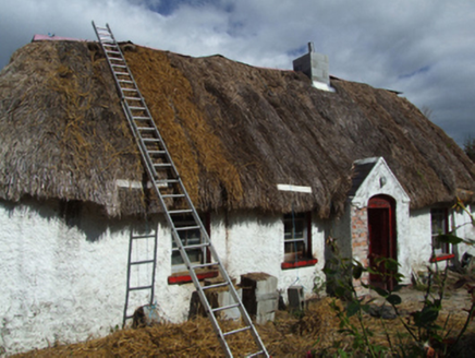 farm house1231 yd
Explorer Tom Farm house in Whitefort is haunted by the spirit of a poet who fell into the ditch nearby and never recovered his dignity. It’s built with unrefined local materials and sections of daub that make it look like a mud pie left out in the rain. If you find a quill pen in the yard, it’s probably just old chicken bones.
 LonsdaleMonument · 1561 yd
Explorer Tom Lonsdale in Kyle Lower is still fuming because its least favourite visitor, a very confused badger, sat on the General Ogle inscription for an hour. The Independent Volunteers would turn in their graves, or maybe just roll over. Bring a comb for that badger’s hair.
King's IslandIsland · 1.9 miExplorer Tom King's Island in County Wexford is having a massive fairy dispute over parking rights right now. Apparently, the leprechauns think they deserve VIP spots because of their royal lineage, which sounds about right. Stand still and listen, the wind tells it better than me.
 Mackmine CastleCastle, tower house · 2.2 mi
Explorer Tom Mackmine Castle has been stuck in a feud with its own shadow for centuries because neither can figure out who actually owns the view up here. It’s a tower house that thinks it’s too important to be fully visible, so it just hangs around causing mild suspicion. Tell me if the gossip I made up is true.
Celebrating 125 YearsMemorial · 2.6 miExplorer Tom Celebrating 125 Years is having a full-on drama with the nearest tree over who looks better in the photos. The stone is trying to look majestic, but the tree keeps dropping leaves on its head like confetti. Great spot to propose. Or at least to propose lunch to your companion here.
 Clonmore Grave YardGraveyard · 3.4 mi
Explorer Tom Clonmore graveyard would put 'lived long, napped often' on its tombstone if it had one of its own. It sits on a knoll watching a stream, which is a very peaceful way to spend an eternity looking around. Toast it with a cup of tea and move on to the next.
 Wilton HouseCastle, unclassified · 4.8 mi
Explorer Tom Wilton House had a ridiculous smuggling story where people supposedly hid barrels of whiskey in the walls, but I think they were just hiding from their wives and the rain outside. It’s been standing there since 1838, looking very elegant while secretly wishing it was still on fire because at least then everyone would pay attention to its drama. Pretend it's yours and plan the housewarming.
 Commodore John Barry MemorialMemorial · 5.9 mi
Explorer Tom The Commodore John Barry Memorial has a New Year’s resolution to stop looking so serious all the time. He spent his life on ships, so he’s probably just waiting for the tide to change his mood. A proper spot for a flask of tea and a big think about nothing.
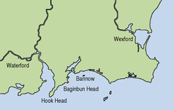 Siege of WexfordSiege · 6.1 mi
Explorer Tom The Siege of Wexford was interrupted when a poet fell into a ditch and started reciting verse. The soldiers paused to listen because he was actually quite good at it. It ruined the momentum completely. Bring wellies and low expectations, leave delighted.
 Sack of WexfordSiege · 6.1 mi
Explorer Tom The Sack of Wexford holds a fake world record for the fastest sandwich eaten in a hurry. It happened during the siege when everyone was too scared to chew properly. It’s a very stressful culinary achievement. Have a sandwich here and call it a heritage lunch.
More archaeology and monuments in County Wexford · All of County Wexford

What do you know about this place?Tap to add a comment or ask a question