Places near here
Photo credits
- National Inventory of Architectural Heritage
- originally uploaded to the English Wikipedia by w:User:Jtdirl, Wikimedia Commons · Public domain
- 瑞丽江的河水, Wikimedia Commons · CC BY-SA 4.0
- James Allan, Wikimedia Commons · CC BY-SA 2.0
- James Allan, Geograph · CC BY-SA 2.0
- Colin Park, Geograph · CC BY-SA 2.0
- Sitomon, Wikimedia Commons · CC BY-SA 2.0
- Robert Bone, Geograph · CC BY-SA 2.0
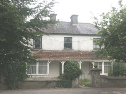 QuidaraHouse · 686 yd
Explorer Tom Quidara in Blessington Demesne has a hidden message carved into its stones that just says 'Please mow the lawn' in tiny letters. It’s an early 20th-century house that’s been neglected so much it’s become part of the landscape, like a stubborn weed with good bones. I bet if you tap the wall three times, it sighs and tells you to go away.
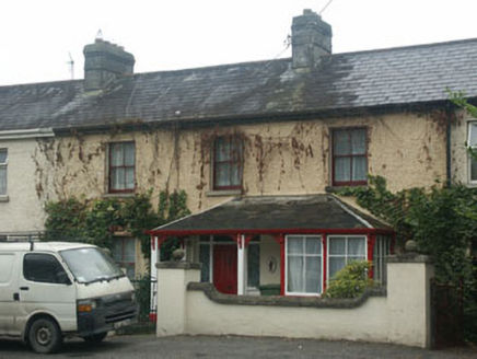 Mountain View HouseHouse · 718 yd
Explorer Tom Mountain View House in Blessington would write 'looking for a partner who appreciates late Edwardian charm and doesn't mind a bit of dust' on its dating profile. It’s the best preserved example of an early 20th-century dwelling in town and very proud of it. Give it a discreet look!
Blessington DemesneWood · 797 ydExplorer Tom Blessington Demesne in County Wicklow is locked in a bitter feud with the next village over something involving a stolen garden gnome. The demesne trees are all facing that direction, glaring daggers at the village center while pretending to be perfectly relaxed and calm. Take a breath of that air, it's older than your car.
The Square RenewalMemorial · 991 ydExplorer Tom The Square Renewal would win any county fair by simply standing there looking extremely dignified and bored. It’s got a knack for making you feel like you’re wearing the wrong socks. Bring a map, get lost anyway, that's the fun.
 Proclamation of the Irish RepublicMemorial · 1389 yd
Explorer Tom Proclamation of the Irish Republic was built on a bargain that promised free tea for everyone who attended the ceremony. Nobody actually got any tea, but the spirit remains undeniably strong. Ideal for a moody photo you'll pretend wasn't posed.
 Rath Turtle MoatFairy fort / ringfort · 1.1 mi
Explorer Tom Rath Turtle Moat sounds like a creature that sleeps for centuries, and honestly, given how high its platform is, I’d bet it does. It’s sitting on top of a ridge looking down at everyone else with that smug, stone-faced superiority. Look up, the best bit is always higher than you think.
 CrossCross, High cross (present location) · 1.3 mi
Explorer Tom Cross in Burgage More has unusually long arms and a small boss, looking like it’s stretching before a very serious workout. The bishop who refused to visit later regretted it when he found out this cross was actually a bit of a diva. Snap one photo, then put the phone away and actually look.
 Burgage CastleRuins · 1.8 mi
 Castle (in ruins)Castle, tower house · 1.8 mi
Explorer Tom Castle in Burgage More is playing hide-and-seek with me. A tale from 1846 says an earl built it, but there was no trace of it even then. Take a picture for me if you pass!
 Cupidstown HillMountain / peak · 3.6 mi
 European Yew4.2 mi
 Sorrel HillMountain / peak · 4.3 mi
More archaeology and monuments in County Wicklow · All of County Wicklow

What do you know about this place?Tap to add a comment or ask a question