What is recorded here
In pasture. Depicted as diamond-shaped area (c. 40m N-S; c. 40m E-W) planted with trees and enclosed by solid line on 1905 and 1935 OS 6-inch maps; sides slightly concave. According to local information, consisted of a 'ring', levelled during land reclamation in 1980s. May have been a tree ring, c. 250m to S of Modeligo House and on E side of avenue. Circular enclosure (13634) lies c. 80m to SE in same field.
From the National Monuments Service (Archaeological Survey of Ireland) record CO037-009
The monument record does not grant public access. Check the route and ask the landowner before entering private land.
- What survives
- Recorded monument
Places near here
Photo credits
- National Inventory of Architectural Heritage
- Jonathan Billinger, Geograph · CC BY-SA 2.0
- Mike Searle, Wikimedia Commons · CC BY-SA 2.0
- Hywel Williams, Wikimedia Commons · CC BY-SA 2.0
- Jonathan Thacker, Geograph · CC BY-SA 2.0
- Jonathan Thacker, Geograph · Creative Commons Attribution-ShareAlike 2.0
 Modeligo HouseFolly · 177 yd
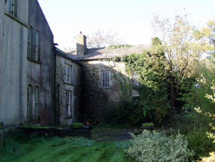 Modeligo HouseHouse · 297 ydMocollop Picnic SitePicnic place · 1.8 mi
 Sheanmore Castle (in ruins)Castle, tower house · 1.8 mi
 Conna Castle (in Ruins)Castle, tower house · 2.3 miGraveyard in Curraheen (kinnatalloon By.)Graveyard · 2.6 miCastlebrook forestWood · 2.6 miSaint Micheal's Holy WellSpring · 2.9 miAghern CemeteryWood · 3.4 mi
 Holy Well4.3 mi
 Coole WellVisitor information · 4.3 mi
 Graveyard4.8 mi
More archaeology and monuments in County Cork · All of County Cork
What do you know about this place?