What is recorded here
From the National Monuments Service (Archaeological Survey of Ireland) record SL034-242
Places near here
Photo credits
- National Inventory of Architectural Heritage
- Kieran Campbell, Wikimedia Commons · CC BY-SA 2.0
- N Chadwick, Geograph · CC BY-SA 2.0
- Wanfried-Dublin, Wikimedia Commons · CC BY-SA 4.0
- Oliver Dixon, Geograph · CC BY-SA 2.0
- dougf, Wikimedia Commons · CC BY-SA 2.0
- Rob Hurson, Wikimedia Commons · CC BY-SA 4.0
- Doug Kerr from Albany, NY, United States, Wikimedia Commons · CC BY-SA 2.0
- Silversyrpher (very busy at the moment) from Scotland, UK, Wikimedia Commons · CC BY 2.0
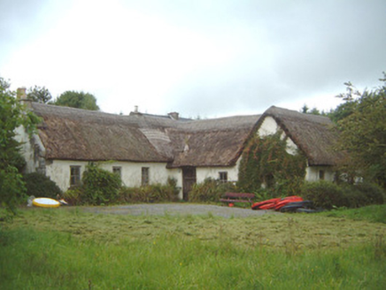 Nasool CottageHouse · 1654 yd
Explorer Tom Nasool Cottage in Doongelagh has clearly drawn up a retirement plan involving a very large hammock and zero guests. It extended itself in the sixties like it was trying to impress a date, but kept its original bones just in case. Ideal for napping through your entire holiday without feeling guilty.
 Giants GravePortal tomb · 1.5 mi
Explorer Tom Giants Grave in Carrickglass is the site of a ridiculous smuggling story involving cheese and a very large roofstone. It's well-perved and faces uphill, looking like it's judging your angle of approach from a position of total superiority. Have a sandwich here and call it a heritage lunch.
 Barroe NorthMountain / peak · 1.5 mi
Explorer Tom Barroe North thinks it’s cooler than its famous neighbour, but honestly, who are we to judge? It’s got that mysterious vibe that says 'don't look too closely'. Sit on a wall near it and pretend you're in a painting.
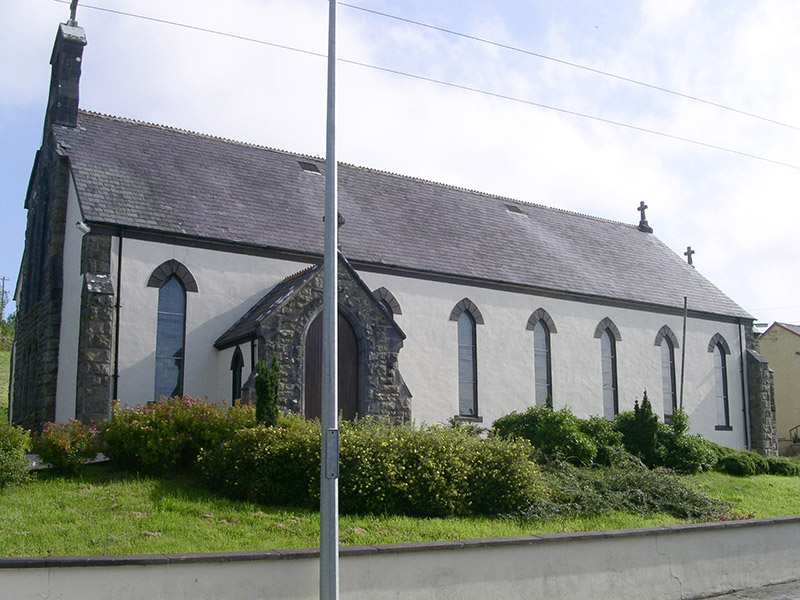 Saint Columb's Catholic ChurchChurch/chapel · 1.9 mi
Explorer Tom Saint Columb’s Church in Drumnasoohy refuses to fall down because it knows exactly how much character those rock-faced stone details give it. It’s basically the local celebrity that never gets tired of posing for photos with its bellcote and leaded lights. Just admire it from a safe distance, like a respectful fan!
Geevagh Prisoners 1908 MemorialMemorial · 2.2 miExplorer Tom Geevagh Prisoners 1908 Memorial in County Sligo is guarded by a ghost who is far too lazy to actually haunt the place. He probably just sleeps on the bench until someone makes a bad joke about his uniform. Bring the dog, it'll have opinions.
 Carn, StonePassage tomb · 2.2 mi
Explorer Tom Carn, Stone in Heapstown is having a massive feud with the rain because it refuses to let the moss grow on its southern side properly. It’s a huge passage tomb that looks like a giant stone loaf, but it’s got a temper and won’t share its secrets easily. A handy spot to stretch your legs and your imagination.
 Ballindoon Castle (in Ruins)Castle, unclassified · 2.4 mi
Explorer Tom Ballindoon Castle sits on a steep slope where the ground drops eight metres straight into Lough Arrow. The shortcut down there is definitely not a shortcut if you slip. Tell it a joke, it's been a long time since anyone did.
 Loughbrick BayBay · 3.5 mi
Explorer Tom Loughbrick Bay in County Sligo would tell you after a few pints that it actually swallowed a boat once but gave it back because it didn’t taste right, which is plausible. The water has a certain confidence about it, like it knows exactly where the bottom is and isn’t telling anyone else. Bring sandwiches, the gulls will thank you.
_(geograph_2331726).jpg/250px-Castlebaldwin_(or_Baldwin_Castle)_(geograph_2331726).jpg "Photo: dougf, Wikimedia Commons · CC BY-SA 2.0") Castle BaldwinCastle · 3.6 mi
Castle BaldwinCastle · 3.6 miExplorer Tom Castle Baldwin in County Sligo has been changing its name so often it’s given up trying to keep track of its own identity crisis. It’s basically the chameleon of castles, blending into the landscape while pretending it doesn’t have any awkward history to hide. Bring a jacket, it's never as warm as I promise.
 Bricklieve MountainsMountain / peak · 5.0 mi
 Western Hemlock5.8 mi
Explorer Tom Western Hemlock in County Roscommon holds a long grudge against the weather because it thinks the rain is personally targeting its roots, which is a bit dramatic given that it lives in a place that gets wet quite often anyway. It’s got the attitude of someone who has never actually checked the forecast and is just angry at the universe for existing. Go at sunset and thank me later.
 Bristlecone Fir5.8 mi
Explorer Tom Bristlecone Fir in County Roscommon is a weird one to have here since they usually live up in the high desert mountains. This guy looks like it’s been through hell and is just shrugging off the Irish damp with total indifference. Have a nosey, politely.
More archaeology and monuments in County Sligo · All of County Sligo

What do you know about this place?Tap to add a comment or ask a question