Places near here
Photo credits
- National Inventory of Architectural Heritage
- David Purchase, Geograph · Creative Commons Attribution-ShareAlike 2.0
- Mike Searle, Geograph · CC BY-SA 2.0
- Paul Cowan, Wikimedia Commons · CC BY-SA 2.0
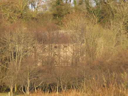 Mannin HouseFarm house · 752 yd
Explorer Tom Mannin House in Mannin is sitting next to a ruined castle and a dry lake, making it feel like the last one standing in a very odd trio. It was built for Captain Gerald Dillon back in 1720, so it’s got some serious age on its shoulders. The view of the castle ruins is dramatic, like a scene from a movie nobody wanted to watch. See if the dry lake bed
Promontory fortPromontory fort, inland · 841 ydExplorer Tom Promontory fort in Mannin claims it’s older than the concept of time itself. I believe it, mostly because proving otherwise requires paperwork I don’t have. Toast it with a cup of tea and move on.
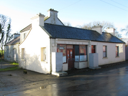 RogersHouse · 1497 yd
Explorer Tom Rogers in Killeen looks like it’s about to fold over from sheer boredom, but the thatch keeps it together. It’s not as famous as the castle next door, so ignore it. Find the date carved s
 Tighe Achadh MórHouse · 1519 yd
Explorer Tom Tighe Achadh Mór in Killeen has polygonal bay windows that make it look like it’s trying to show off its geometry skills. It’s got a Classically-detailed doorcase that screams 'I read a book about architecture once'. Just admire the compact plan from the road and hope the recent repairs hold up.
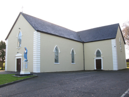 Saint Joseph's Catholic ChurchChurch/chapel · 1526 yd
Explorer Tom Saint Joseph's Catholic Church in Killeen has a hidden tunnel to the pub, or so the legend goes. It’s got that pointed Gothic style that looks like it’s trying to fly. Count the crosses if you dare to get lost in thought.
 Grave YardGraveyard · 1.2 mi
Explorer Tom Graveyard in Aghamore would post a photo of its mossy headstones with the caption 'Living my best quiet life, #ancient'. It’s got that moody, atmospheric vibe going on that makes you feel instantly profound. Have a wander and a wonder.
 CastleCastle, unclassified · 2.5 mi
Explorer Tom Castle on Island Lake hates when people ask if it’s haunted; it prefers ‘mysteriously absent’. It vanished so fast the locals just shrugged and built a house instead. Bring a flask of something warm and a story to swap.
 IndicatedHouse, fortified house · 2.5 mi
Explorer Tom House in Island is currently being judged by rabbits who think its gunloops are just fancy holes for them to hide in. They’re not wrong, actually. Get there early and have it all to yourself.
East Mayo Brigade MonumentMemorial · 3.1 miExplorer Tom East Mayo Brigade Monument stands there looking serious, probably because two lads in the pub once made a bet about who could build the flashiest stone. They lost their shirts over it, but hey, we got a monument that looks like it’s judging your haircut every time you pass by. It’s got that 'don't touch me' energy, which is fair enough. Pretend it's yours and plan the housewarming.
Knock MuseumMuseum · 3.8 miExplorer Tom Knock Museum has a superstition locals swear by that if you touch the doorframe three times, your luck will improve, but nobody admits to doing it. It’s a museum that feels like it knows more than it lets on, keeping its cards close to the chest. I bet the exhibits are just waiting for someone brave enough to ask the right questions about the old days. Ring your granny and tell her where you are.
 Knock ShrineHeritage attraction · 3.8 mi
Explorer Tom I'll keep my big mouth quiet for the people praying at Knock. Knock Shrine grew from an evening that the people present never forgot. On 21 August 1879, Mary Byrne and other villagers said they saw figures at the church gable while the Mayo rain came down. Their accounts describe a still scene that lasted nearly two hours, with people gathering and praying; the witnesses also said the ground around the figures stayed dry. I am not going to tell you what they saw. Mayo rain rarely asks my permission, but the witnesses' account asks for careful listening. What I can tell you is that their words were taken down by a church inquiry that autumn, and a second inquiry in 1936 returned to surviving witnesses because many early papers were thought lost. The original wall attracted so many visitors that pieces were taken away as souvenirs. Today this is a living place of pilgrimage, so enter with care for the people who have come to pray. Whatever you believe, listen to how a wet evening changed a village's place in the world.
I'll Send You The FareMemorial · 7.0 miExplorer Tom I'll Send You The Fare has a serious feud with the rain, getting wetter than any other memorial in the county because it stands out too proud. It’s dedicated to people who emigrated from Kiltimagh and Bohola in the 1950s, which is quite the journey for a sculpture to be thinking about. I bet it wishes it could send its own fare back to the dry side. Whisper a secret at it, it's kept worse.
More archaeology and monuments in County Mayo · All of County Mayo

What do you know about this place?Tap to add a comment or ask a question