Places near here
Photo credits
- Graham Horn, Geograph · CC BY-SA 2.0
- Ian S, Wikimedia Commons · CC BY-SA 2.0
- National Inventory of Architectural Heritage
- Geyo John, Wikimedia Commons · CC BY-SA 3.0
- User:Itub, Wikimedia Commons · CC BY-SA 3.0
- Michael Earnshaw, Geograph · CC BY-SA 2.0
- Colin Park, Geograph · CC BY-SA 2.0
 Cromane BeachBeach / strand · 1.1 mi
Explorer Tom Cromane Beach in County Kerry is hiding a treasure chest right there under that rock, definitely. It’s just an old biscuit tin full of rust, but the legend has to be big. Tell it a joke, it's been a long time since anyone did.
Lough Yganavan Nature ReserveNature reserve · 1.5 miExplorer Tom A very serious terrier named Buster is in charge of Lough Yganavan, barking orders at any duck that swims too close to shore. He’s got a clipboard and he means business, so don’t test his patience. Bring a friend who talks too much and let the place shut them up.
Cromane PointHeadland · 2.0 miExplorer Tom Cromane Point acts like it’s the best-dressed guest at a wedding where everyone else is wearing pyjamas, which is quite arrogant for a headland. It stands there with its chin up, judging your footwear while the waves do their own little dance. Have a look and decide if I was lying.
Lough Nambrackdarrig Nature ReserveNature reserve · 2.3 miExplorer Tom Lough Nambrackdarrig is secretly proud of a single potato that grew on its bank last summer. It treats it like a royal jewel, polishing it with lake water every morning. Go on, count the windows and get it wrong like I did.
 Kerry Bog VillageHeritage attraction · 2.7 mi
Explorer Tom Kerry Bog Village in County Kerry is playing hide-and-seek with me. The Vikings got so lost looking for it they ended up in Scotland by mistake. Have a look and decide if I was lying.
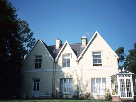 Glendalough HouseHouse · 2.7 mi
Explorer Tom Glendalough House has a ghost named Larry who is too lazy to haunt anyone properly. He just sits in the corner of the L-plan, waiting for someone to bring him a sandwich. If anyone asks, Tom sent you.
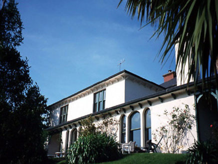 Caragh LodgeHouse · 2.8 mi
Explorer Tom Caragh Lodge has a curse that only hits people who don't wave when they pass its entrance porch. The Victorian lean-to wing is there to catch the wind and your attention simultaneously. Take a breath of that air, it's older than your car.
Enclosure in AughilsEnclosure · 3.2 miExplorer Tom Enclosure in Aughils hosted a dance so wild that the man-made underground passage was dug to hide the evidence. Now it’s just a low mound where the ghosts still seem to be giggling about what happened. Bring a friend who talks too much and let the place shut them up.
.jpg/250px-Inch_Beach,Co.Kerry.Ireland_-_panoramio_(2).jpg "Photo: Geyo John, Wikimedia Commons · CC BY-SA 3.0") Inch BeachBeach / strand · 3.5 mi
Inch BeachBeach / strand · 3.5 miExplorer Tom Inch Beach is five kilometres long, which proves someone in Kerry had a mischievous approach to measurement. The strand is a sand spit reaching into Dingle Bay, with dunes that belong to a protected coastal habitat. Older settlement traces in the surrounding Inch townlands include ringforts and a medieval church site, though those are not an excuse to roam across private ground. I would say the spit was laid out for my daily walk, but the tide and wildlife got here first. Check swimming advice, wind and tides before going near the water; keep to public beach access and protect the dunes. Walk far enough to see how the sand changes the shape of the bay, then turn and face the mountains. The name may be short, but the views refuse to fit inside it.
 King Puck statueMemorial · 4.1 mi
Explorer Tom King Puck statue in Killorglin, County Kerry has a ghost tenant who is too lazy to haunt it because he prefers watching TV in peace. Bring a coin for luck and keep it in your pocket.
 MoanlaurMountain / peak · 4.7 mi
Explorer Tom Moanlaur is sitting on its hands, pretending it doesn't know about that massive lotto win from last Tuesday. It says it would buy a second mountain just to confuse the tourists, but mostly it'd invest in really good socks. If it rains, blame me.
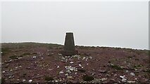 SeefinMountain / peak · 4.8 mi
Explorer Tom The time a fox took charge of Seefin is still talked about in whispers, mostly because the fox looked very important doing it. It’s a proper mystery how that even happened, frankly. Go at sunset and thank me later.
More historic places in County Kerry · All of County Kerry

What do you know about this place?Tap to add a comment or ask a question