What is recorded here
Hachured as circular enclosure on OS 6-inch map (1842) (diam. c. 30m). Defined by earthen bank (H 1.4m), stone faced in parts. Interior and bank heavily overgrown and inaccessible.
From the National Monuments Service (Archaeological Survey of Ireland) record CO122-085
The monument record does not grant public access. Check the route and ask the landowner before entering private land.
- What survives
- Recorded monument
Places near here
Photo credits
- National Inventory of Architectural Heritage
- Mike Searle, Wikimedia Commons · CC BY-SA 2.0
- Ceoil at English Wikipedia, Wikimedia Commons · CC BY-SA 3.0
- Maker named on the Wikimedia Commons picture page · Public domain
- Kenneth Allen, Geograph · CC BY-SA 2.0
- Marathon, Wikimedia Commons · CC BY-SA 2.0
- Neville Goodman, Geograph · CC BY-SA 2.0
- Jonathan Pascall, Geograph · CC BY-SA 2.0
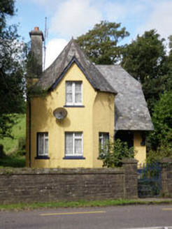 Lisselan HouseGate lodge · 363 yd
 Lisselan Golf ClubWorker's house · 388 ydGarden WoodWood · 619 ydBattle of the Big Cross (1798) Memorial MonumentMonument · 1690 yd
 Ballinoroher CastleCastle · 1.1 mi
 Stone CircleStone circle, multiple-stone · 1.6 mi
 Templebryan Stone CircleArchaeological place · 1.6 mi
 English holly1.7 mi
 Clonakilty Tourist OfficeVisitor information · 2.7 mi
 Michael Collins House MuseumMuseum · 2.9 mi
 Clonakilty HarbourBay · 3.0 mi
 Inchydoney BeachBeach / strand · 3.9 mi
More archaeology and monuments in County Cork · All of County Cork
What do you know about this place?