
What is recorded here
Towards the top of the W-facing slope of a drumlin. Rectangular grass and rush-covered area (dims. 24.5m NE-SW; 20.5-23.5m NW-SE) defined by an earthen bank at NE (Wth 5.5m; int. H 1.2m; ext. H 1.45m) and SE (Wth 2.6m; int. H 0.3m; ext. H 1.4m), and the base of a bank (Wth 2.5m; int. H 0.05m; ext. H 1m) at NW. There are fosses (Wth of top 3.7-5m; D 0.4m) on each side, but those at NE and SE have been re-cut as drains (D 1.25-1.4m). There is an outer bank (Wth 3.4m; ext. H 1.4m) at SW. Earthwork (RO001-001-) is c. 180m to the SW.
From the National Monuments Service (Archaeological Survey of Ireland) record RO001-002
Places near here
Photo credits
- National Inventory of Architectural Heritage
- Doug Kerr from Albany, NY, United States, Wikimedia Commons · CC BY-SA 2.0
- Silversyrpher (very busy at the moment) from Scotland, UK, Wikimedia Commons · CC BY 2.0
- N Chadwick, Geograph · CC BY-SA 2.0
- Colin Park, Wikimedia Commons · CC BY-SA 2.0
- Oliver Dixon, Geograph · CC BY-SA 2.0
- Kieran Campbell, Wikimedia Commons · CC BY-SA 2.0
- Daniel Waters, Co. Sligo, Ireland from Ireland, Wikimedia Commons · CC BY 2.0
Indicated (1838).Fairy fort / earthen ringfort · 434 yd water pump1176 ydAlderford HouseGates/railings/walls · 1262 ydWestern Hemlock1.8 miBristlecone Fir1.8 miBarroe NorthMountain / peak · 3.6 miArigna Mining ExperienceVisitor attraction · 3.8 miLoughbrick BayBay · 4.0 miGiants GravePortal tomb · 4.1 miBallindoon Castle (in Ruins)Castle, unclassified · 4.3 miScardan WaterfallWaterfall · 4.9 miBallinafad CastleCastle · 6.2 mi
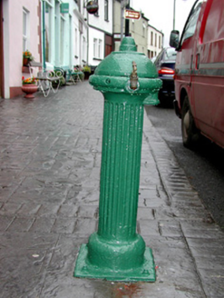 water pump1176 yd
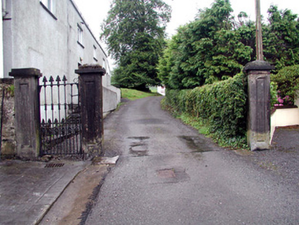 Alderford HouseGates/railings/walls · 1262 yd
 Western Hemlock1.8 mi
 Bristlecone Fir1.8 mi
 Barroe NorthMountain / peak · 3.6 mi
 Arigna Mining ExperienceVisitor attraction · 3.8 mi
 Loughbrick BayBay · 4.0 mi
 Giants GravePortal tomb · 4.1 mi
 Ballindoon Castle (in Ruins)Castle, unclassified · 4.3 mi
 Scardan WaterfallWaterfall · 4.9 mi
 Ballinafad CastleCastle · 6.2 mi
More archaeology and monuments in County Roscommon · All of County Roscommon

What do you know about this place?Tap to add a comment or ask a question