What is recorded here
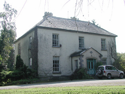
Situated on a slight rise of ground in undulating countryside. Described in the Civil Survey (1654-6) as a 'Demolished castle with a slate house adioyneing to the sd castle, the walls only standing' (Simington 1934, vol. 2, 221) and shown as a castle on the Down Survey. Daniel O Meara is listed as proprietor in 1640 (ibid.). A mid-eighteenth-century house occupies this location. No visible evidence of the earlier structure. The occupier did not know of any early features in the building.
The above description is derived from 'The Archaeological Inventory of County Tipperary. Vol. 1 - North Tipperary' compiled by Jean Farrelly and Caimin O'Brien (Dublin: Stationery Office, 2002). In certain instances the entries have been revised and updated in the light of recent research.
Date of upload/revision: 22 September 2008
The monument record does not grant public access. Check the route and ask the landowner before entering private land.
- What survives
- Recorded monument
Places near here
 Lissanisky Housecountry house · 59 yd
 Shanbally Househouse · 752 yd
 Habitation site in ClashnevinHabitation site · 1368 yd
 Enclosure in LismoreEnclosure · 1402 yd
 Ballymackey CastleCastle · 1699 yd
 Ballintotty Castle (in ruins)Castle, tower house · 1.6 mi
 James Devaney MemorialMemorial · 2.9 mi
 Kyleroe WoodWood · 3.4 mi
 Gibbet HillMountain / peak · 3.4 mi
 Interragh HillMountain / peak · 3.8 mi
 Ballycapple WoodForest · 4.1 mi
 Old BarracksHeritage attraction · 4.3 mi