What is recorded here
Indicated is a ruined cashel in County Clare, Ireland, where marsh water still moves around stones that men took for walls. Its circle measures twenty-seven metres across, but most of the structure has collapsed into grass and scattered rubble. The place may have housed people, excluded cattle, or marked a boundary for neighbours who no longer speak its name. What remains is a shallow line of stones and two gaps wide enough for livestock, waiting for someone to stop calling it an enclosure and begin asking what it enclosed.
In a level marshy area overlooked by higher ground to the NW, N and S. Hachured on both the first (1842) and Cassini (1920) editions of the OS 6-inch map. Listed as ‘Enclosure’ in the RMP (1996). This subcircular cashel (diams. 27.2m N-S; 24.5m E-W) is defined from W-N-NNE by a very low collapsed and grass-covered rubble spread (H 0.2m; Wth 2.9m). Elsewhere, the wall’s core has been removed, leaving only the intermittent remains of its inner and outer facing stones (Wth 2-3m; H 0.1-0.15m). From NE-E-SE a clearance cairn or wall rubble lie on the line of the cashel wall and there are two narrow livestock gaps at SE.
Compiled by: Gearóid Conroy and Conn Herriott
Date of upload: 3-10-2025
This remains an important historical record, but the official description says the monument is no longer visible or has been destroyed. The monument record does not grant public access. Check the route and ask the landowner before entering private land.
- What survives
- No visible remains or recorded as destroyed
Places near here
 IndicatedFairy fort / stone ringfort · 239 yd
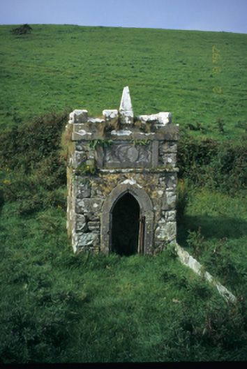 Spa Wellwell · 1008 yd
 Saint Bridget's Wellholy well · 1188 yd
 St Bridgets WellHoly well · 1190 yd
 Bridget's Well;St Bridget's WellSpring · 1195 yd
 John P. Holland CentreMuseum · 1.3 mi
 Cliffs of Moher Visitor CentreVisitor information · 1.3 mi
 Liscannor Castle (in Ruins)Castle, tower house · 1.5 mi
 Sea StackMountain / peak · 1.7 mi
 Cliffs of MoherCliff · 1.7 mi
 CastleCastle, unclassified · 1.9 mi
 Doolin Cliff WalkWalking route · 2.5 mi