What is recorded here
In pasture on a slight N-facing slope, with excellent views to the N, W and E, poorer views to the S onto higher ground. Located 275m W of the townland boundary Garranroe, ringfort (LI021-049---) 275m to SW and a large enclosure (LI021-052----) lies 430m to SE. Depicted as a large circular-shaped enclosure (diam. c.…
Read the whole record
From the National Monuments Service (Archaeological Survey of Ireland) record LI021-051
Places near here
Photo credits
- National Inventory of Architectural Heritage
- Mike Searle, Wikimedia Commons · CC BY-SA 2.0
- Callanmurphy, Wikimedia Commons · CC BY-SA 4.0
- Olivier BEZES, Wikimedia Commons · CC BY 2.5
- Jean-Pol GRANDMONT, Wikimedia Commons · CC BY 3.0
- Peter Craine, Wikimedia Commons · CC BY-SA 2.0
- Adareman, Wikimedia Commons · CC BY-SA 4.0
Explorer Tom Burnt spread in Garranroe witnessed a cow once drop a wheelbarrow of potatoes, which was the most dramatic event for centuries. It’s just black dirt now, but it remembers the chaos. Bring sandwiches, the gulls will thank you.
 bridge709 yd
_-_geograph.org.uk_-_6276354.jpg/250px-Castles_of_Munster,_Fanningstown,_Limerick_(1)_-_geograph.org.uk_-_6276354.jpg "Photo: Mike Searle, Wikimedia Commons · CC BY-SA 2.0") Fanningstown CastleCountry house, castle/fortified house · 1.2 mi
Fanningstown CastleCountry house, castle/fortified house · 1.2 miExplorer Tom Fanningstown Castle in Fanningstown would tell its younger self to stop trying so hard with those round towers. It looks like it’s permanently mid-sneeze, all crenellated and confused by the 1800s additions. Mind the nettles, they’re probably guarding the secrets.
Fanningstown Castle (in ruins)Castle, tower house · 1.2 miExplorer Tom Fanningstown Castle holds the world record for the most confusing conversion from ruin to luxury B&B. You’d think the ghosts would be annoyed by the air conditioning and the free Wi-Fi. Bring a coin for luck and keep it in your pocket.
 Franciscan AbbeyArchaeological place · 1.7 mi
 Lebanon Cedar1.7 mi
Explorer Tom Lebanon Cedar in County Limerick would cope on a reality show by refusing to speak for three weeks straight. It just radiates smugness while the other trees panic about the lighting changes. Walk past slowly like you're in a film.
_-_geograph.org.uk_-_4570265.jpg/250px-Castles_of_Munster,_Ballinveala,_Limerick_(3)_-_geograph.org.uk_-_4570265.jpg "Photo: Mike Searle, Wikimedia Commons · CC BY-SA 2.0") Ballinveala Castle (in ruins)Castle, tower house · 1.8 mi
Ballinveala Castle (in ruins)Castle, tower house · 1.8 miExplorer Tom Ballinveala Castle nearly got famous when someone almost found it but looked in the wrong field. It’s four stories of brickwork pretending to be taller than it actually is. Take the long way round, it deserves the effort.
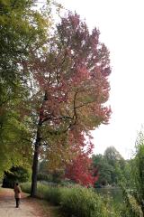 American Sweetgum1.8 mi
Explorer Tom American Sweetgum is in a rivalry with a more famous tree just to prove it has better leaves. It’s not an Irish native, but it fits right in with its star-shaped foliage. Pick a stone, any stone, and invent its biography.
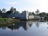 Adare Desmond CastleMedieval castle · 2.0 mi
Explorer Tom Adare Desmond Castle was built in the twelfth century but got dismantled in 1657, which is quite rude. It nearly became famous for its restoration work instead of history. Great spot to propose. Or at least to propose lunch.
 Desmond CastleHeritage attraction · 2.0 miBiodiversity in the Maigue CatchmentVisitor information · 3.2 miVilliers WellSpring · 4.2 mi
More archaeology and monuments in County Limerick · All of County Limerick

What do you know about this place?Tap to add a comment or ask a question