What is recorded here
In pasture, located on a low E–W ridge, straddling the gentle S-facing slope. There is a stream/drain c. 100m to W. This rath is shown on the 1838 OS 6-inch map but is not shown on the 1929 edition. It consists of a slightly raised, circular area (24m N–S; 22m E–S) defined by remnants of an earthen bank. The bank…
Read the whole record
From the National Monuments Service (Archaeological Survey of Ireland) record MA022-059
Places near here
Photo credits
- National Inventory of Architectural Heritage
- Edward S. Siebert, Wikimedia Commons · Public domain
- Andreas F. Borchert, Wikimedia Commons · CC BY-SA 4.0
- JohnArmagh, Wikimedia Commons · CC BY-SA 3.0
- Gordon Hatton, Wikimedia Commons · CC BY-SA 2.0
- Steve Edge, Geograph · CC BY-SA 2.0
- Mike Searle, Wikimedia Commons · CC BY-SA 2.0
- N Chadwick, Wikimedia Commons · CC BY-SA 2.0
- Richard Webb, Geograph · CC BY-SA 2.0
- Milesoneill, Wikimedia Commons · Public domain
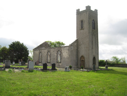 Ballysakeery Church (Ballysakeery)Church/chapel · 602 yd
Explorer Tom Ballysakeery Church would post its own photos online with captions like ‘Vibe Check: Passed’ and no filters whatsoever. It’s been standing there since 1809, pretending it hasn’t seen every bad hair day in town. Find the date carved somewhere if you’re brave.
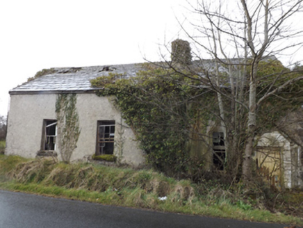 school639 yd
Explorer Tom Lisglennon school holds a fake world record for the most dust particles per square inch of floor. It sits next to a ruined church like an old friend who refuses to admit they’re tired. Hum something sad nearby, it’ll start humming back just to annoy you.
 Battle of KillalaBattle · 2.0 mi
 Cathedral in Townplots WestCathedral · 2.0 mi
 Round tower in Townplots WestRound tower · 2.1 mi
Explorer Tom Round tower in Townplots West sits in the middle of Killala, looking like it’s guarding something very boring. A fox took charge of the place for a whole decade once. Make a wish, it's had centuries of practice.
 Killala Round TowerVisitor attraction · 2.1 mi
 Moyne AbbeyHeritage attraction · 2.7 mi
 Rinnaun PointHeadland · 3.0 mi
 Rathroe CastleCastle · 3.5 mi
 Templemurry GraveyardCemetery · 3.7 mi
 Belleek WoodsWood · 5.0 mi
 Battle of BallinaBattle · 5.5 mi
More archaeology and monuments in County Mayo · All of County Mayo

What do you know about this place?Tap to add a comment or ask a question