What is recorded here
In flat pasture with good views in all directions with a rectangular enclosure (TS043-018002-) in the field immediately to the N. The ruins of a nearby farmhouse are in corner of field to the E. This building is not marked on any edition of the OS 6-inch maps but may pre-date the 1st (1840) ed. as the outline of the…
Read the whole record
From the National Monuments Service (Archaeological Survey of Ireland) record TS043-018001
Places near here
Photo credits
- Maker not stated on source page, commons.wikimedia.org
- National Inventory of Architectural Heritage
- Maker not stated on source page, www.gettyimages.com.au
- Maker not stated on source page, allthatsinteresting.com
- Maker not stated on source page, tr.pinterest.com
- Mike Searle, Wikimedia Commons · CC BY-SA 2.0
- Maker not stated on source page, www.flickr.com
- Maker not stated on source page, ca.wikipedia.org
- kevin higgins, Geograph · CC BY-SA 2.0
 Enclosure in Lisduff (kilcooly Par.)Enclosure · 103 yd
Explorer Tom Enclosure in Lisduff is rectangular, which is weird for a ringfort, so I suspect it’s actually a giant mud bath for…
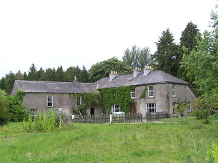 George's ParkHouse · 1452 yd
Explorer Tom George's Park in Kilcoolyabbey got lost looking for itself when the Vikings were here. The summerhouse and bellcote…
 Aglish GraveyardCemetery · 1543 yd
Explorer Tom Legend has it a goat once ruled this Aglish Graveyard with an iron hoof and terrible breath. It ate all the nice moss…
 Lisduff BridgeBridge · 1667 yd
Explorer Tom Lisduff Bridge in Ballynascarry is blaming the mapmakers for drawing it too small because it wants to look bigger in…
 Kilcooly AbbeyBoathouse · 1712 yd
Explorer Tom Kilcooly Abbey has a fake front that looks like a church but isn’t, which is a bit cheeky of it. I heard a goat once…
 Church in Ballynascarry (gore)Church · 1.1 mi
Explorer Tom Church in Ballynascarry thinks the road leading to it is too slow and full of potholes. It was abandoned before 1700…
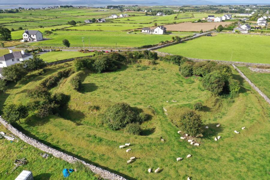 Fairy fort / earthen ringfort in GlenreaghFairy fort / earthen ringfort · 1.1 mi
Explorer Tom Fairy fort / earthen ringfort in Glenreagh took four million cups of tea to build. It’s overgrown and sitting on a…
 Fairy fort / earthen ringfort in GarnagaleFairy fort / earthen ringfort · 1.2 mi
Explorer Tom Fairy fort / earthen ringfort in Garnagale hears gossip through its thick walls. The fairies are definitely talking…
 CastleCastle, tower house · 1.7 mi
Explorer Tom This tower house in Garryhiggin had a massive feud with the next village over something daft, probably about whose…
 Saint Patrick's GraveyardGraveyard · 1.8 mi
Explorer Tom Saint Patrick's Graveyard in County Kilkenny was mislabeled by map makers who clearly didn't check their spelling…
 Fennor Castle (in Ruins)Bawn · 2.0 mi
Explorer Tom Fennor Castle Bawn would win a county fair in the 'Most Disappointing Prize' category with its hands behind its back…
 Wellington MonumentViewpoint · 2.3 mi
Explorer Tom Wellington Monument in County Tipperary was built by Sir William Barker in 1817, but legend says he really just wanted…
More archaeology and monuments in County Tipperary · All of County Tipperary

What do you know about this place?Tap to add a comment or ask a question