
Places near here
Photo credits
- Kieran Campbell, Wikimedia Commons · CC BY-SA 2.0
- National Inventory of Architectural Heritage
- Kieran Campbell, Geograph · CC BY-SA 2.0
- Malene Thyssen, Wikimedia Commons · CC BY-SA 3.0
- David Baird, Geograph · CC BY-SA 2.0
- David Baird, Wikimedia Commons · CC BY-SA 2.0
- Sailko, Wikimedia Commons · CC BY 3.0
Explorer Tom This Tobernagauhoge ringfort claims to have an imaginary twin across the sea that looks exactly like it, which is convenient because we can’t see either one clearly. It’s levelled out, so it’s just a field boundary now pretending to be history with a straight face. Perfect spot to practise your best tour-guide voice.
 CastleCastle, motte and bailey · 1096 yd
Explorer Tom Dunnamona's motte is in a bitter feud with the next village over about who invented the perfect way to eat potatoes without butter. The tension is palpable; locals won't even look at each other across the field, making for an incredibly awkward picnic spot. Take the long way round, it deserves the effort.
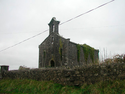 Saint Canice's Church (Kilkenny West)Church/chapel · 1540 yd
Explorer Tom Saint Canice's Church in Kilkenny West was ignored by the bishop who refused to visit because he didn't like the lack of a roof. It is now a roofless ruin with curious circular disks that might be vents or just fancy holes. Look up at the sky through it and wonder.
 Church in Kilkenny AbbeyChurch · 1541 yd
Explorer Tom Kilkenny Abbey is where a cow once tried to buy the whole place with a very aggressive moo. It’s got that roofless charm that makes you feel like you’re in a really bad historical drama. Sit on a wall near it and pretend you're in a painting.
Kilkenny CastleCastle · 1608 ydExplorer Tom Kilkenny Castle smells like old cheese and expensive perfume mixed together in a damp cellar. Tom swears he can smell the regret of the last person who left their hat there. Walk past slowly like you're in a film.
Noughaval CemeteryArchaeological place · 2.0 miExplorer Tom Noughaval Cemetery is resting near a ditch where a poet once fell in dramatically. The grass is thick with stories of people who took shortcuts they shouldn't have. Take a breath of that air, it's older than your car.
 European Beech3.4 mi
Explorer Tom European Beech in County Longford is doing a bit of a one-man show with its leaves. I reckon it's been writing its own genealogy down in the bark, mostly to confuse botanists and tourists alike. Stick around for the light changing, it's a real spectacle.
Killinure BayBay · 4.3 miExplorer Tom Killinure Bay is hiding a message in its stones that only appears when the tide is exactly right, which is basically never for most of us. It’s waiting patiently for someone to notice the pattern before it changes again next month, keeping everyone on their toes. Stand where the owner stood and practise looking smug.
Traveen BayBay · 4.8 miExplorer Tom Traveen Bay would ace a job interview by promising endless relaxation and zero deadlines, though its weather forecast might be slightly unreliable. It’s very confident in its sales pitch about how peaceful things are out here until the wind picks up. Bring sandwiches, the gulls will thank you for sharing.
 Leveret IslandIslet · 5.1 mi
Explorer Tom Leveret Island would tell you it’s a fancy yacht if you asked nicely enough, I reckon. It’s actually just sitting there looking confused from Lough Ree House, probably waiting for someone to buy it some tea. Wave at the cows, they're the real locals.
 InchbofinIslet · 5.7 mi
Explorer Tom Inchbofin in County Westmeath would write on its dating profile: 'Island with history, no drama.' It’s the island of the white cow, or so the legends keep repeating. Sit on a wall near it and pretend you're in a painting.
 Ecclesiastical enclosure in InchbofinEcclesiastical enclosure · 5.7 mi
Explorer Tom Ecclesiastical enclosure in Inchbofin would tell its younger self to stop worrying about the pond levels and start praying harder. Founded by St. Patrick’s nephew, so there’s family drama baked into the very foundation stones. Bring biscuits, every good story needs biscuits and maybe a nap.
More archaeology and monuments in County Westmeath · All of County Westmeath

What do you know about this place?Tap to add a comment or ask a question