
Places near here
Photo credits
- National Inventory of Architectural Heritage
- Kmcnamee, Wikimedia Commons · CC BY-SA 4.0
- Mike Searle, Wikimedia Commons · CC BY-SA 2.0
- Berthold Strucken, Wikimedia Commons · CC BY-SA 4.0
- Ridiculopathy, Wikimedia Commons · CC BY-SA 4.0
- Adrian Beney, Wikimedia Commons · CC BY-SA 2.0
- Colin Park, Geograph · CC BY-SA 2.0
- Keith Salvesen, Geograph · CC BY-SA 2.0
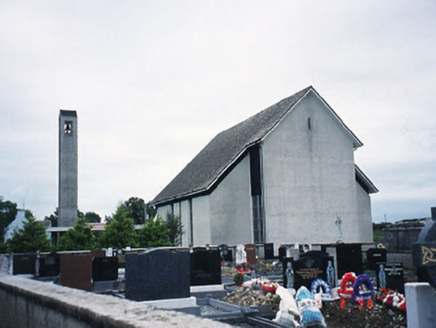 Catholic Church of the Immaculate ConceptionChurch/chapel · 2.4 mi
Explorer Tom Catholic Church of the Immaculate Conception in Listry would write 'Looking for someone to share bread with' on its…
 Listry GAA pitchGAA ground · 2.8 mi
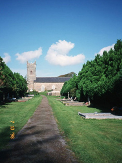 Saint Carthage's Church (Kiltallagh)Church/chapel · 2.9 mi
Explorer Tom Saint Carthage's Church (Kiltallagh) made a New Year's resolution to stop leaking water but it failed spectacularly.…
Páirc de Búrca, Milltown/CastlemaineGAA ground · 3.1 mi Ballymalis CastleCastle · 4.6 mi
Explorer Tom Ballymalis Castle is currently run by a very stern terrier who demands a treat before you can even look at the walls.…
 Ballymalis Castle (in ruins)Castle, tower house · 4.6 mi
Explorer Tom Ballymalis Castle has had so many names in its lifetime that it’s basically a chameleon, changing its identity every…
 Dunloe Ogham StonesHeritage attraction · 5.8 mi
Explorer Tom Eight ogham stones stand together at Coolmagort near Beaufort, and they have travelled through several lives without…
 Aghadoe Early Medieval Ecclesiastical SiteHeritage attraction · 6.1 mi
Explorer Tom Aghadoe's ruined church and round-tower base sit above Killarney with enough carved stone to make you slow down, even…
 Ogham stone in Kilcoolaght EastOgham stone · 6.5 mi
Explorer Tom Ogham stone in Kilcoolaght East is wearing its best face while hiding behind those iron railings. Apparently, a church…
 Lamb IslandIsland · 7.5 mi
Explorer Tom Lamb Island in County Kerry has made its New Year’s resolution to finally stop being so stubbornly round. It says it’s…
 Circular WalkWalking route · 7.6 mi
Explorer Tom Circular Walk in County Kerry hosted a dance last year that went too far because someone spilled punch on the grass and…
 Innisfallen Abbey (in Ruins)Ecclesiastical site · 7.8 mi
Explorer Tom Innisfallen Abbey makes a low moaning sound at night that sounds suspiciously like a monk clearing his throat. It’s…
More archaeology and monuments in County Kerry · All of County Kerry

What do you know about this place?Tap to add a comment or ask a question