Places near here
Photo credits
- National Inventory of Architectural Heritage
- Charles W Glynn, Wikimedia Commons · CC BY-SA 2.0
- P L Chadwick, Wikimedia Commons · CC BY-SA 2.0
- Maker not stated on source page, www.pinterest.com
- Maker not stated on source page, uk.pinterest.com
- Maker not stated on source page, www.irishcentral.com
- Kmcnamee, Wikimedia Commons · CC BY-SA 4.0
- Maker not stated on source page, commons.wikimedia.org
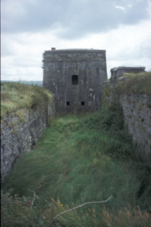 Kilkerin FortBattery · 152 yd
Explorer Tom Kilkerin Fort in Lakyle North is a six-bay fort built c. 1810 surrounded by a moat, which adds a bit of drama to the…
 Tarbert LighthouseLighthouse · 1.3 mi
Explorer Tom Tarbert Lighthouse has been in a bitter feud with the next village over something daft, maybe who invented the perfect…
 Clonderalaw BayBay · 1.5 mi
Explorer Tom Clonderalaw Bay is incredibly proud of its ability to reflect the sky without any effort whatsoever. It thinks that…
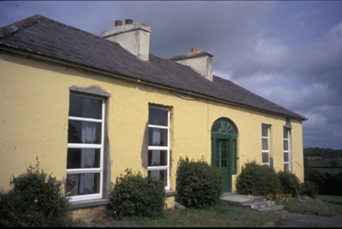 OaklandsHouse · 1.8 mi
Explorer Tom Oaklands in Knock (Clonderalaw), County Clare lost its wings in the 80s but kept its dignity. Built around 1800, it’s a…
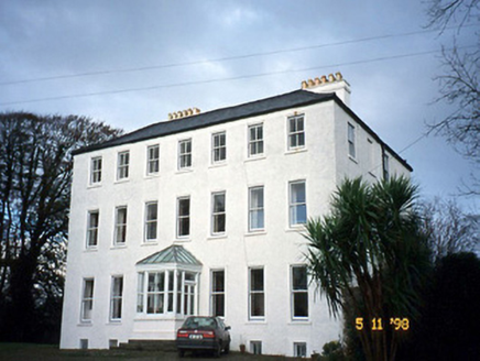 Tarbert HouseHouse · 2.0 mi
Explorer Tom Tarbert House is so Georgian and stuffy that even the Vikings got lost looking for it. They kept walking past because…
 CastleCastle, unclassified · 2.1 mi
Explorer Tom Castle in Tarbert was built around 1450 but nobody mentions it during the Desmond wars. It might have been a manor…
 Fairy fort / stone ringfort in TarbertFairy fort / stone ringfort · 2.4 mi
Explorer Tom Fairy fort in Tarbert would definitely get 'Died Before The Internet' engraved on its tombstone if it ever decided to…
 creamery2.5 mi
Explorer Tom Creamery in Tieraclea Lower was saved by a hero nobody remembers who fixed the arch. Now it’s just a wall, but with…
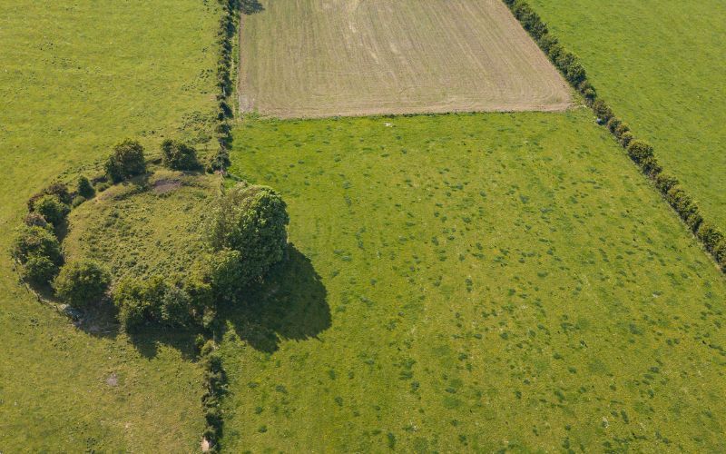 Fairy fort / earthen ringfort in KilpaddogeFairy fort / earthen ringfort · 2.9 mi
Explorer Tom Fairy fort / earthen ringfort in Kilpaddoge was where a fiddler played all night long until his fingers bled and the…
 Glin GAA pitchGAA ground · 3.5 mi
 Mapped graveyardGraveyard · 4.1 mi
Explorer Tom This mapped graveyard in County Kerry brags about surviving a massive storm that flattened everything else nearby…
 Ballymacrinan BayBay · 4.6 mi
Explorer Tom Ballymacrinan Bay is run by a dog who thinks he’s the local king and barks at every cloud that passes overhead. It’s…
More historic places in County Clare · All of County Clare

What do you know about this place?Tap to add a comment or ask a question