
What is recorded here
Indicated is a submerged Claret fort where reeds still choke the ditch and hide the room where people lived. It stands barely twenty metres across in marshy pasture, close enough to touch the boundary stream and far enough from road noise to keep its quiet. The earth bank has worn to a low scar, but the shape remains clear when rain fills the fosse and the whole circle floats on water.
In low-lying marshy pasture overlooked by higher ground to N, c. 38m N of a SW-flowing stream that forms the townland boundary with Ballyellery and with views across Liscannor Bay to the S. Hachured on both the first (1840) and Cassini (1916) editions of the OS 6-inch maps. Classified as an enclosure in the RMP (1996). A subcircular rath (19.6m E-W; 18m N-S) is defined by the remains of an inner earthen bank (Wth 1.9m; int. H 0.15-0.55m) from W-NW, which has been reduced to a low scarp (H 0.2m) elsewhere, and by a shallow outer fosse (Wth 2.2m; ext. D 0.15-0.2m) which is water-logged and filled with reeds and rushes. The interior is level and covered in reeds. An enclosure (CL015-150----) lies c.105m to the NNE.
Compiled by: Gearóid Conroy and Eve Campbell
Date of upload: 7-10-2025
The monument record does not grant public access. Check the route and ask the landowner before entering private land.
- What survives
- Recorded monument
Places near here
 Enclosure in LaghcloonEnclosure · 175 yd
 Kilmacreehy Ch. (in ruins)Church · 363 yd
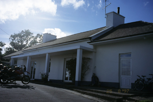 Sandfield Lodgehouse · 1232 yd
 Liscannor Fort (Site of)Fairy fort / earthen ringfort · 1392 yd
 Lahinch BeachBeach / strand · 1441 yd
 Dough CastleRuins · 1619 yd
 John P. Holland CentreMuseum · 1.1 mi
 Liscannor Castle (in Ruins)Castle, tower house · 1.2 mi
 Bridget's Well;St Bridget's WellSpring · 2.2 mi
 Kilmanahn GraveyardRuins · 2.3 mi
 Famine MemorialMemorial · 2.4 mi
 Liscannor BayBay · 2.9 mi
Other information
Photo: Credit not shown in the picture search · Rights wording not checked; contact us if this picture should be removed