
Places near here
Photo credits
- National Inventory of Architectural Heritage
- Reading Tom, Wikimedia Commons · CC BY 2.0
- Davidcorry200, Wikimedia Commons · CC BY-SA 4.0
- Laurel Lodged, Wikimedia Commons · CC0
- Algirdas at Lithuanian Wikipedia, Wikimedia Commons · Public domain
- Miguel Angel Masegosa Martínez, Wikimedia Commons · CC BY 2.0
Explorer Tom St Patricks Well in Kilbeg is marked on old maps as being in a water-logged fosse, which sounds like a terrible place to stand for a holy ritual, but locals still swear by it. A fiddler once played there all night until the cows started dancing, or so the story goes. Stick around for the light changing, it's a show.
Goat IslandIslet · 2.3 miExplorer Tom Goat Island claims the local bishop refused to visit because he was afraid the goats would eat his vestments during the service, which is quite specific actually. It’s a story that keeps coming up whenever we talk about weird religious history in this part of Roscommon county. Bring a camera and your most suspicious face.
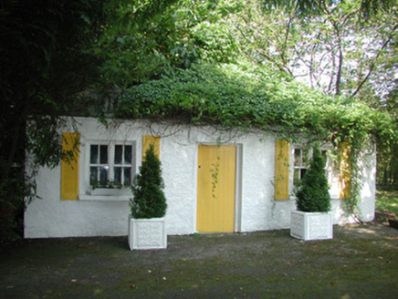 Mount AshleighGate lodge · 2.4 mi
Explorer Tom Mount Ashleigh gate lodge in Glebe would survive a zombie attack simply by closing its gates and hoping they forget about the tasty timber sash windows. The house behind it got rebuilt, so the lodge is basically the last original witness to all the changes over the years. Flash your lights at it; it likes showing off its piers.
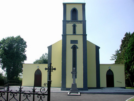 Catholic Church of Our Lady of Mount CarmelChurch/chapel · 2.5 mi
Explorer Tom Our Lady of Mount Carmel in Roosky has got the altar on the wrong end of the building, apparently. The map makers were so confused they just gave up and drew it upside down. Stand outside and look properly baffled for the cameras if you can manage it.
Rabbit IslandIslet · 2.6 miExplorer Tom Rabbit Island was supposedly saved by a hero nobody remembers who lost his hat there in 1602. He probably tripped over a root and blamed the rabbit for his bad luck ever since. Ideal stop for a big stretch, a bigger yawn, and zero actual history.
 Cavan & Leitrim RailwayMuseum · 4.0 mi
 Grave YardGraveyard · 4.5 miCastleCastle, unclassified · 4.5 mi
Explorer Tom Castle in County Roscommon is hiding from the weather, which has a long grudge against it. Lewis mentioned it in 1837, but nobody can find it now. Get there early and have it all to yourself.
St. Barry's WellSpring · 4.7 miExplorer Tom St. Barry's Well in County Roscommon describes the 1800s to teenagers as 'a time when everyone walked everywhere and complained about their feet.' It’s very proud of its stone rim, which it claims is original and definitely not just a fancy rock. Stand where the owner stood and practise looking smug, like you own the place.
 Strokestown ParkHeritage attraction · 5.1 mi
Explorer Tom Strokestown Park is hiding a treasure that is definitely just a biscuit tin with a very dramatic backstory attached to it. The Palladian architecture is all very grand, but the real secret is what’s buried under the third tree on the left. Take a mate and argue about what it was for.
 Pedunculate Oak5.3 mi
Explorer Tom Pedunculate Oak in County Roscommon is haunted by a ghost who is far too lazy to actually haunt it, so it just sits there looking vaguely disappointed while everyone else does the work. It’s like a supernatural slacker that has given up on the whole spooky business before it even started properly. Hum something sad nearby, it adds atmosphere.
 Sweet Chestnut5.4 mi
Explorer Tom Sweet Chestnut in County Roscommon decided to give up its acorns for Lent this year because it felt they were too heavy on its conscience, which is a very spiritual move for a tree that mostly just stands there looking smug about its own existence. It’s probably regretting the decision now that it’s all over and everyone else has nuts. Look for the ghost, then pretend you didn't.
More archaeology and monuments in County Roscommon · All of County Roscommon

What do you know about this place?Tap to add a comment or ask a question